Image:Map Parthian Empire-fr.png
Un article de Wikipédia, l'encyclopédie libre.
Taille de cet aperçu : 800 × 414 pixels
Image en plus haute résolution (1 766 × 914 pixels, taille du fichier : 351 Kio, type MIME : image/png)
| | Ce fichier provient de Wikimedia Commons?. Les informations le concernant sont affichées ci-dessous (procédure). |
| Description |
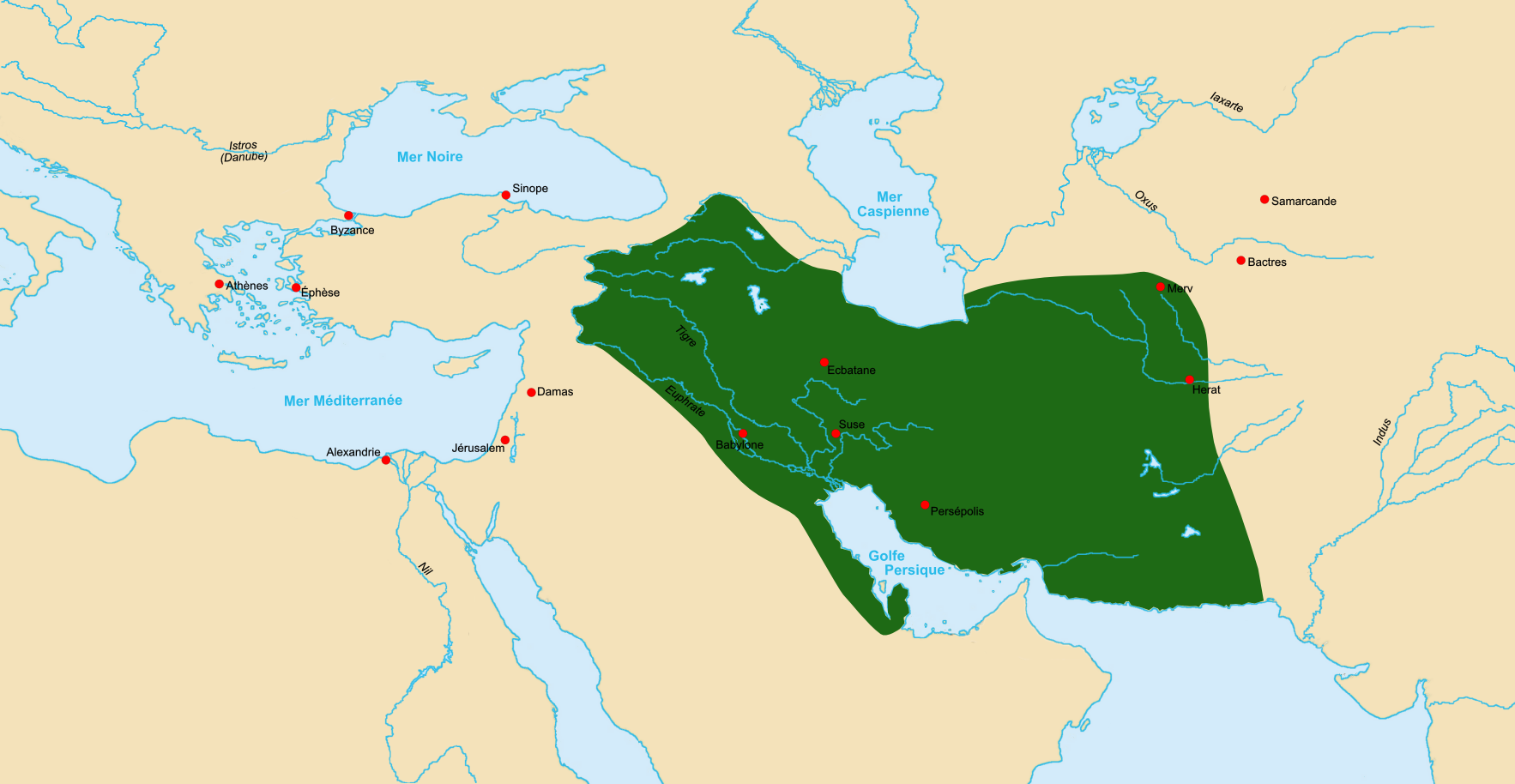
Map of Parthian Empire ca 60 BCE. |
|||
|---|---|---|---|---|
| Source |
Made using Image:LocationParthia.PNG as a source. |
|||
| Date |
7 october 2006 |
|||
| Author | ||||
| Permission (Reusing this image) |
|
Historique du fichier
Cliquer sur une date et une heure pour voir le fichier tel qu’il était à ce moment-là
| Date et heure | Dimensions | Utilisateur | Commentaire | |
|---|---|---|---|---|
| actuel | 7 octobre 2006 à 17:25 | 1 766×914 (351 Kio) | Fabienkhan | ({{Information |Description=Map of Parthian Empire ca 60 BCE. |Source=Made using Image:LocationParthia.PNG as a source. |Date=7 october 2006 |Author=Fabienkhan |Permission={{self|cc-by-sa-2.5}} |other_versions= }} [[Category:His) |
Pages contenant l’image
Les pages ci-dessous contiennent cette image :

