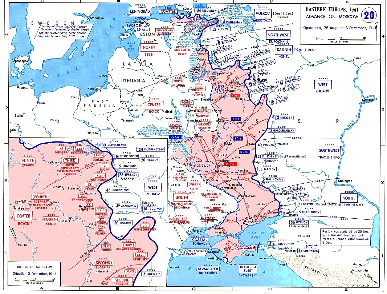
Image:Map Operation Typhoon.jpg
Un article de Wikipédia, l'encyclopédie libre.
Taille de cet aperçu : 788 × 600 pixels
Image en plus haute résolution (1 256 × 956 pixels, taille du fichier : 208 Kio, type MIME : image/jpeg)
| | Ce fichier provient de Wikimedia Commons?. Les informations le concernant sont affichées ci-dessous (procédure). |
From [1]
PD as it is work of USGOV. |Source=Originally from [2]; description page is/was here. |Date=2006-08-07 (original upload date) |Author=Original uploader was Grafikm fr at en.wikipedia |Permission=PD-LAYOUT; PD-USGOV. |other_versions= }}
[edit] License information
cellspacing="8" cellpadding="0" style="width:100%; clear:both; margin:0.5em auto; background-color:#f7f8ff; border:2px solid #8888aa;"
| This work is in the public domain in the United States because it is a work of the United States Federal Government under the terms of Title 17, Chapter 1, Section 105 of the US Code. See Copyright.
Note: This only applies to works of the Federal Government and not to the work of any individual U.S. state, territory, commonwealth, county, municipality, or any other subdivision. العربية | Български | Česky | Deutsch | English | Español | Français | Magyar | Italiano | 日本語 | 한국어 | Polski | Português | 中文(繁體) | 中文(简体) | +/- |
 |
[edit] Original upload log
(All user names refer to en.wikipedia)
- 2006-08-07 18:58 Grafikm fr 1256×956×8 (212615 bytes) Map of the operation Typhoon in 1941. From [http://www.dean.usma.edu/history/web03/atlases/atlas%20table%20of%20contents.htm] PD as it is work of USGOV.
Historique du fichier
Cliquer sur une date et une heure pour voir le fichier tel qu’il était à ce moment-là
| Date et heure | Dimensions | Utilisateur | Commentaire | |
|---|---|---|---|---|
| actuel | 10 décembre 2006 à 11:56 | 1 256×956 (208 Kio) | MatthiasKabel | (From [http://www.dean.usma.edu/history/web03/atlases/atlas%20table%20of%20contents.htm] PD as it is work of USGOV. |Source=Originally from [http://en.wikipedia.org en.wikipedia]; description page is/was [http://en.wikipedia.org/w/index.php?title=Image%3A) |
Pages contenant l’image
Les pages ci-dessous contiennent cette image :

