Image:Manhattan map.jpg
Un article de Wikipédia, l'encyclopédie libre.
Taille de cet aperçu : 327 × 599 pixels
Image en plus haute résolution (729 × 1 335 pixels, taille du fichier : 256 Kio, type MIME : image/jpeg)
| | Ce fichier provient de Wikimedia Commons?. Les informations le concernant sont affichées ci-dessous (procédure). |
| Description |
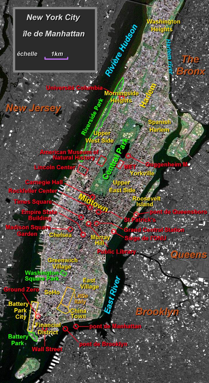
Manhattan map |
|---|---|
| Source |
photo USGS EROS Data Center Satellite Systems Branch, legend by Luna04 |
| Date |
23 juillet 2004 |
| Author | |
| Permission (Reusing this image) |
Released under the GNU Free Documentation License. |
| Other versions | fr:Image:Manhattan map.jpg |
[edit] License information

[edit] Original upload log
(All user names refer to fr.wikipedia)
- 23 juillet 2004 à 21:27 . . Luna04 (Discuter | Contributions) . . 729×1335 (261 663 octets) (Carte de Manhattan - New York (quartiers, sites et parcs). Réalisation personnelle sur fond de photo satellite du domaine public NASA/USGS Credit Image provided by the USGS EROS Data Center Satellite Systems Branch. Publiée pour Wikipedia en GFDL {{GFDL)
Historique du fichier
Cliquer sur une date et une heure pour voir le fichier tel qu’il était à ce moment-là
| Date et heure | Dimensions | Utilisateur | Commentaire | |
|---|---|---|---|---|
| actuel | 4 juillet 2006 à 00:30 | 729×1 335 (256 Kio) | HenryS | ({{Information |Description=Manhattan map |Source=French Wikipedia Images |Date= |Author=USGS EROS Data Center Satellite Systems Branch |Permission=NASA/USGS Public Domain |other_versions=fr:Image:Manhattan map.jpg }}) |
Pages contenant l’image
La page ci-dessous contient cette image :

