Image:Madeira 71.jpg
Un article de Wikipédia, l'encyclopédie libre.

Taille de cet aperçu : 800 × 447 pixels
Image en plus haute résolution (1 844 × 1 030 pixels, taille du fichier : 324 Kio, type MIME : image/jpeg)
| | Ce fichier provient de Wikimedia Commons?. Les informations le concernant sont affichées ci-dessous (procédure). |
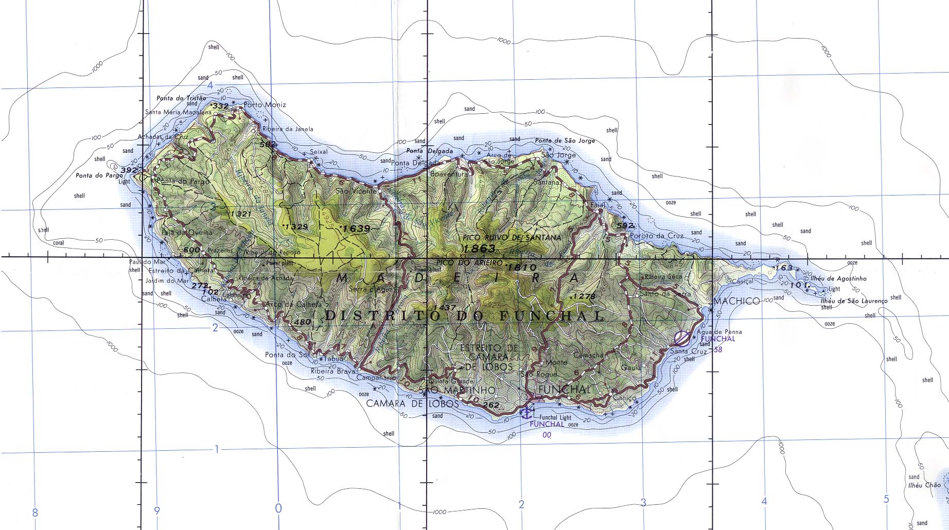
Madeira (Portugal) Original scale 1:250,000. Portion of Joint Operations Graphic (Ground) sheet NI 28-13, U.S. Defense Mapping Agency 1976 (325K) Not for navigational use
http://www.lib.utexas.edu/maps/polar.html (Polar Regions and Oceans Maps)
http://www.lib.utexas.edu/maps/islands_oceans_poles/madeira_71.jpg
Note: This is not a copyright tag! Many images that use this tag are likely to be in the public domain, but many images, like for example images from WWII taken by members of the axis powers are not. Images must contain a valid copyright tag in addition to this one! For example:
or any other appropriate license tag. |
|
| This image is a copy of madeira_71.jpg, a map from the map collection of the Perry-Castañeda Library (PCL) of the University of Texas at Austin. According to the FAQs it might be in the public domain, but please provide additional proof for that. | |
| This image is a work of a U.S. military or Department of Defense employee, taken or made during the course of an employee's official duties. As a work of the U.S. federal government, the image is in the public domain. See the DoD copyright policy. |
 |
Historique du fichier
Cliquer sur une date et une heure pour voir le fichier tel qu’il était à ce moment-là
| Date et heure | Dimensions | Utilisateur | Commentaire | |
|---|---|---|---|---|
| actuel | 8 février 2005 à 09:30 | 1 844×1 030 (324 Kio) | Davenbelle | (# Madeira (Portugal) Original scale 1:250,000. Portion of Joint Operations Graphic (Ground) sheet NI 28-13, U.S. Defense Mapping Agency 1976 (325K) Not for navigational use ) |
Pages contenant l’image
La page ci-dessous contient cette image :

