Image:México División Política-República Central.png
Un article de Wikipédia, l'encyclopédie libre.
Taille de cet aperçu : 557 × 599 pixels
Image en plus haute résolution (1 098 × 1 181 pixels, taille du fichier : 319 Kio, type MIME : image/png)
| | Ce fichier provient de Wikimedia Commons?. Les informations le concernant sont affichées ci-dessous (procédure). |
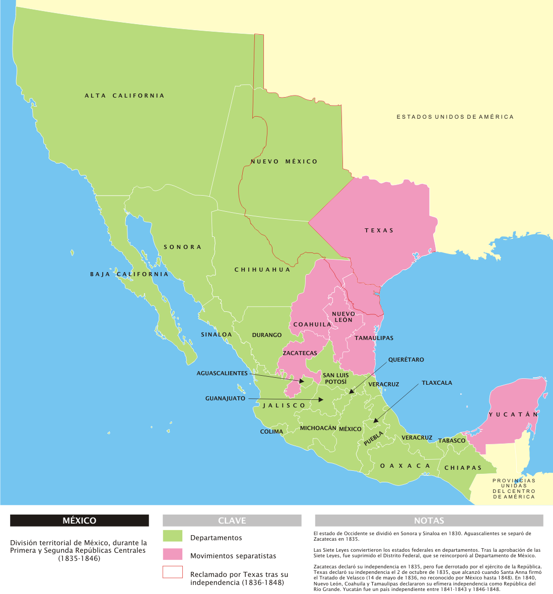
| Description |
Español: Mapa de la organización territorial de México durante las Repúblicas Centralistas (1835-1846), con notas en español.
|
||
|---|---|---|---|
| Source |
Trabajo propio |
||
| Date |
29 de marzo de 2007 |
||
| Author |
Yavidaxiu |
||
| Permission (Reusing this image) |
|
 |
This map image should be recreated using vector graphics as an SVG file. This has several advantages; see Commons:Media for cleanup for more information. If an SVG form of this image is already available, please upload it. After uploading an SVG, replace this template with template {{Vector version available|new image name.svg}} in this image. |
|
العربية | Български | Català | Česky | Dansk | Deutsch | English | Esperanto | Español | Français | 한국어 | Italiano | Magyar | Lietuvių | Nederlands | 日本語 | Polski | Português | Română | Русский | Suomi | Svenska | Türkçe | Українська | Tiếng Việt | मराठी | 中文(繁體) | 中文(简体) | +/- |
|
Historique du fichier
Cliquer sur une date et une heure pour voir le fichier tel qu’il était à ce moment-là
| Date et heure | Dimensions | Utilisateur | Commentaire | |
|---|---|---|---|---|
| actuel | 29 mars 2007 à 16:53 | 1 098×1 181 (319 Kio) | Yavidaxiu | ({{Information |Description={{es|Mapa de la organización territorial de México durante las Repúblicas Centralistas (1835-1846), con notas en español.}} |Source=Trabajo propio |Date=29 de marzo de 2007 |Author=Yavidaxiu |Permission={{PD-self}} |other_v) |
Pages contenant l’image
Les pages ci-dessous contiennent cette image :

