Image:Lower lough erne.jpg
Un article de Wikipédia, l'encyclopédie libre.
Pas de plus haute résolution disponible.
Lower_lough_erne.jpg (640 × 194 pixels, taille du fichier : 24 Kio, type MIME : image/jpeg)
| | Ce fichier provient de Wikimedia Commons?. Les informations le concernant sont affichées ci-dessous (procédure). |
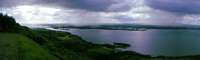
- H0356 : View of Lower Lough Erne from Cliffs of Magho
5 km from Roscor, Ireland
- Source: [1]
Grid Square
   H0356   (find images nearby)
Photographer
   Falcon   (find more nearby)
Image status
   First geograph for H0356
Date Taken
   Sunday, 23 July, 2006
Submitted
   Sunday, 23 July, 2006
Category
   Lough   (find more nearby)
Subject Location
   Irish: H 03 56External link [1000m precision]
   WGS84: 54:27.4081N 7:56.8324W [54.45680,-7.94721]
View Direction
   Northwest (about 315 degrees)
[edit] License
| This file is licensed under Creative Commons Attribution ShareAlike 2.0 License (cc-by-sa-2.0). In short: you are free to share and make derivative works of the file under the conditions that you appropriately attribute it, and that you distribute it under this or a similar cc-by-sa license. |
Historique du fichier
Cliquer sur une date et une heure pour voir le fichier tel qu’il était à ce moment-là
| Date et heure | Dimensions | Utilisateur | Commentaire | |
|---|---|---|---|---|
| actuel | 17 janvier 2007 à 11:43 | 640×194 (24 Kio) | Kanchelskis | (H0356 : View of Lower Lough Erne from Cliffs of Magho 5 km from Roscor, Ireland Grid Square H0356 (find images nearby) Photographer Falcon (find more nearby) Image status First geograph for H0356 Date Taken Sunday, 23 July, 2006 Su) |
Pages contenant l’image
La page ci-dessous contient cette image :

