Image:LocationPalestine.png
Un article de Wikipédia, l'encyclopédie libre.
Pas de plus haute résolution disponible.
LocationPalestine.png (250 × 115 pixels, taille du fichier : 6 Kio, type MIME : image/png)
| | Ce fichier provient de Wikimedia Commons?. Les informations le concernant sont affichées ci-dessous (procédure). |
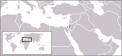
Location map for the Palestine.
Originally created for Spanish Wikipedia by George McFinnigan.
| This image has been (or is hereby) released into the public domain by its author, George McFinnigan at the Spanish Wikipedia project. This applies worldwide. In case this is not legally possible: |
 A vector version of this image (SVG) is available. For more information about vector graphics, read about Commons transition to SVG. Български | Deutsch | English | Español | Français | Galego | עברית | Magyar | Bahasa Indonesia | Italiano | 日本語 | 한국어 | Lietuvių | Polski | Português | Русский | Српски / Srpski | Українська | 中文(简体) | 中文(繁體) | +/- |
 |
Palestine, including Gaza Strip and West Bank
Historique du fichier
Cliquer sur une date et une heure pour voir le fichier tel qu’il était à ce moment-là
| Date et heure | Dimensions | Utilisateur | Commentaire | |
|---|---|---|---|---|
| actuel | 9 septembre 2006 à 13:53 | 250×115 (6 Kio) | Conscious | (Reverted to earlier revision) |
| 9 septembre 2006 à 13:53 | 250×115 (6 Kio) | Conscious | (version from en:, by en:User:W123, GFDL, 13 July 2006) | |
| 6 juin 2006 à 18:40 | 250×115 (6 Kio) | Rain74 | ||
| 7 mars 2006 à 19:32 | 250×115 (6 Kio) | George McFinnigan |
Pages contenant l’image
La page ci-dessous contient cette image :

