Image:LocationMauritius.png
Un article de Wikipédia, l'encyclopédie libre.
Pas de plus haute résolution disponible.
LocationMauritius.png (250 × 119 pixels, taille du fichier : 5 Kio, type MIME : image/png)
| | Ce fichier provient de Wikimedia Commons?. Les informations le concernant sont affichées ci-dessous (procédure). |
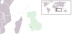
Location map for the Mauritius.
Originally created for English Wikipedia by Vardion.
| This image has been (or is hereby) released into the public domain by its author, Vardion at the English Wikipedia project. This applies worldwide. In case this is not legally possible: |
Historique du fichier
Cliquer sur une date et une heure pour voir le fichier tel qu’il était à ce moment-là
| Date et heure | Dimensions | Utilisateur | Commentaire | |
|---|---|---|---|---|
| actuel | 1 juin 2008 à 16:02 | 250×119 (5 Kio) | Panos84 | ({{Information= Location of the island nation of Mauritius and its exclusive economic zone. |Source= Own work |Date= 01 June 2008 |Author= Panos84 (Panagiotis V. Lazaridis) }}) |
| 5 mars 2008 à 04:55 | 250×119 (5 Kio) | Panos84 | (Location of the island nation of Mauritius and its exclusive economic zone.) | |
| 12 décembre 2004 à 20:32 | 250×115 (5 Kio) | EugeneZelenko | (Location map for the Mauritius.<br/>Originally created for English Wikipedia by Vardion.<br/>{{PD}}<br/>Category:Country locator maps) |
Pages contenant l’image
Les pages ci-dessous contiennent cette image :

