Image:Lincoln Sea map.png
Un article de Wikipédia, l'encyclopédie libre.
Taille de cet aperçu : 657 × 600 pixels
Image en plus haute résolution (1 000 × 913 pixels, taille du fichier : 302 Kio, type MIME : image/png)
| | Ce fichier provient de Wikimedia Commons?. Les informations le concernant sont affichées ci-dessous (procédure). |
| Camera location | This and other geocoded Commons images: | (Info) |
|---|
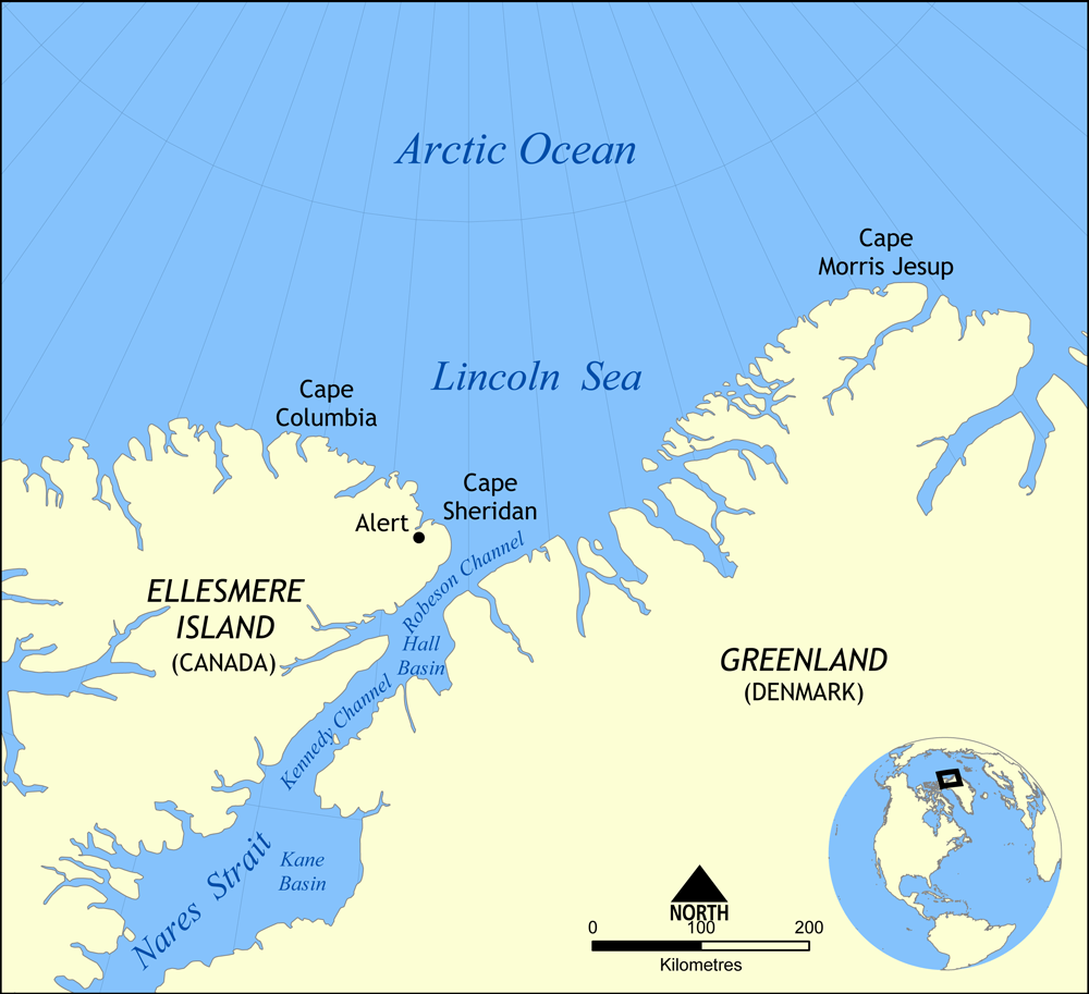
Map showing the location of the Lincoln Sea, part of the Arctic Ocean. Also shows Cape Columbia and Cape Morris Jesup.
Created by NormanEinstein, May 30, 2006.

Historique du fichier
Cliquer sur une date et une heure pour voir le fichier tel qu’il était à ce moment-là
| Date et heure | Dimensions | Utilisateur | Commentaire | |
|---|---|---|---|---|
| actuel | 7 août 2007 à 18:01 | 1 000×913 (302 Kio) | NormanEinstein | (Updated map. Slightly larger size.) |
| 6 août 2007 à 23:14 | 657×600 (185 Kio) | Eivindghoel | ||
| 6 août 2007 à 23:13 | 657×600 (185 Kio) | Eivindghoel | ||
| 30 mai 2006 à 16:02 | 996×909 (104 Kio) | NormanEinstein | ({{Information Map showing the location of the Lincoln Sea, part of the Arctic Ocean. Also shows Cape Columbia and Cape Morris Jesup. Created by NormanEinstein, May 30, 2006. {{GFDL-self}} Category:Maps of seas) |
Pages contenant l’image
Les pages ci-dessous contiennent cette image :

