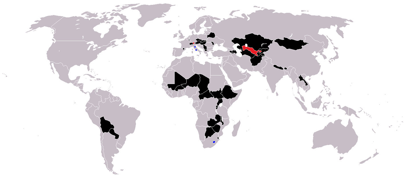
Image:Landlocked countries.png
Un article de Wikipédia, l'encyclopédie libre.
Taille de cet aperçu : 800 × 351 pixels
Image en plus haute résolution (1 425 × 625 pixels, taille du fichier : 30 Kio, type MIME : image/png)
| | Ce fichier provient de Wikimedia Commons?. Les informations le concernant sont affichées ci-dessous (procédure). |
[edit] Countries coloured black on the map
[edit] Licensing
| I, the copyright holder of this work, hereby release it into the public domain. This applies worldwide. In case this is not legally possible: Afrikaans | Alemannisch | Aragonés | العربية | Asturianu | Български | Català | Česky | Cymraeg | Dansk | Deutsch | Eʋegbe | Ελληνικά | English | Español | Esperanto | Euskara | Estremeñu | فارسی | Français | Galego | 한국어 | हिन्दी | Hrvatski | Ido | Bahasa Indonesia | Íslenska | Italiano | עברית | Kurdî / كوردی | Latina | Lietuvių | Latviešu | Magyar | Македонски | Bahasa Melayu | Nederlands | Norsk (bokmål) | Norsk (nynorsk) | 日本語 | Polski | Português | Ripoarisch | Română | Русский | Shqip | Slovenčina | Slovenščina | Српски / Srpski | Svenska | ไทย | Tagalog | Türkçe | Українська | Tiếng Việt | Walon | 中文(简体) | 中文(繁體) | zh-yue-hant | +/- |
Historique du fichier
Cliquer sur une date et une heure pour voir le fichier tel qu’il était à ce moment-là
| Date et heure | Dimensions | Utilisateur | Commentaire | |
|---|---|---|---|---|
| actuel | 25 février 2007 à 18:14 | 1 425×625 (30 Kio) | Aivazovsky | |
| 23 mai 2006 à 11:29 | 1 357×628 (46 Kio) | Stefan040780 | (source: same as old map, updated on 23.5.06 by stefan040780) | |
| 21 juin 2005 à 05:08 | 1 357×628 (25 Kio) | Ævar Arnfjörð Bjarmason | (Landlocked countries, based on Image:BlankMap-World.png. Category:World maps) |
Pages contenant l’image
Les pages ci-dessous contiennent cette image :

