Image:Lake Pontchartrain.png
Un article de Wikipédia, l'encyclopédie libre.
Taille de cet aperçu : 800 × 494 pixels
Image en plus haute résolution (889 × 549 pixels, taille du fichier : 42 Kio, type MIME : image/png)
| | Ce fichier provient de Wikimedia Commons?. Les informations le concernant sont affichées ci-dessous (procédure). |
[edit] Summary
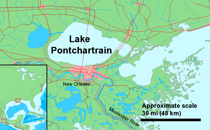
Lake Pontchartrain, Louisiana, USA
Quick map for Hurricane Katrina, needs work
Derived from Demi Public Domain Map Server, Public Domain data sources used
[edit] Licensing

Historique du fichier
Cliquer sur une date et une heure pour voir le fichier tel qu’il était à ce moment-là
| Date et heure | Dimensions | Utilisateur | Commentaire | |
|---|---|---|---|---|
| actuel | 29 novembre 2005 à 19:06 | 889×549 (42 Kio) | Duk | (updated with causway) |
| 30 août 2005 à 20:01 | 889×549 (41 Kio) | Duk | (rm demi watermark) | |
| 30 août 2005 à 19:47 | 889×549 (41 Kio) | Duk | (Lake Pontcharin, Louisiana, USA Quick map for Hurricane Katrina, needs work Derived from [http://www2.demis.nl/mapserver/mapper.asp Demi Public Domain Map Server], [http://www2.demis.nl/mapserver/DataSrc.htm Public Domain data sources used] ) |
Pages contenant l’image
La page ci-dessous contient cette image :

