Image:Kourou carte map 1776.jpg
Un article de Wikipédia, l'encyclopédie libre.
Taille de cet aperçu : 585 × 600 pixels
Image en plus haute résolution (1 055 × 1 082 pixels, taille du fichier : 343 Kio, type MIME : image/jpeg)
| | Ce fichier provient de Wikimedia Commons?. Les informations le concernant sont affichées ci-dessous (procédure). |
[edit] Summary
| Description |
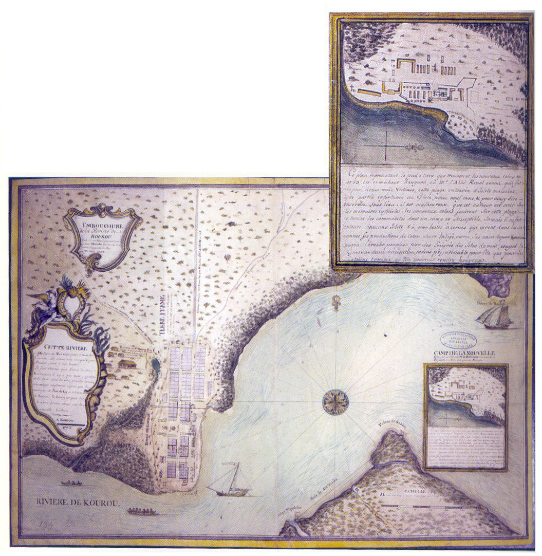
English: Map showing Kourou in 1776 and detail of the expedition camp as planned by Brûletout de Préfontaine in 1763, before the arrival of the colonists.
Français : Carte montrant le bourg de Kourou en 1776 et un détail du camp de l'expédition comme prévu par Brûletout de Préfontaine en 1763, avant l'arrivée des colons.
|
|---|---|
| Source |
Bernard Montabo ; Le Grand livre de l'histoire de la Guyane ; volume I ; Collection Le Grand Livre ; Éditions Orphie, 2004. |
| Date |
early 1776 |
| Author |
unknown |
| Permission (Reusing this image) |
PD-old |
[edit] Licensing
| This image (or other media file) is in the public domain because its copyright has expired. This applies to the United States, Canada, the European Union and those countries with a copyright term of life of the author plus 70 years.
العربية | Asturianu | Български | Català | Česky | Dansk | Deutsch | English | Ελληνικά | Esperanto | Español | Euskara | فارسی | Français | Gaeilge | Galego | עברית | हिन्दी | Bahasa Indonesia | Italiano | 日本語 | 한국어 | Kurdî / كوردی | Lietuvių | Magyar | Nederlands | Norsk (nynorsk) | Македонски | Bahasa Melayu | Polski | Português | Română | Русский | Slovenčina | Slovenščina | Shqip | Suomi | Sámegiella | Türkçe | 中文(简体) | 中文(繁體) | 粵語 | +/- |
Historique du fichier
Cliquer sur une date et une heure pour voir le fichier tel qu’il était à ce moment-là
| Date et heure | Dimensions | Utilisateur | Commentaire | |
|---|---|---|---|---|
| actuel | 10 juin 2007 à 20:34 | 1 055×1 082 (343 Kio) | Arria Belli | ({{Information |Description= {{en|Map showing Kourou and detail of the expedition camp as planned by Brûletout de Préfontaine before the arrival of the colonists.}} {{fr|Carte montrant le bourg de Kourou et un détail du camp de l'expédition com) |
Pages contenant l’image
La page ci-dessous contient cette image :

