Image:Kerch Strait Landsat.jpg
Un article de Wikipédia, l'encyclopédie libre.
Taille de cet aperçu : 800 × 600 pixels
Image en plus haute résolution (1 600 × 1 200 pixels, taille du fichier : 294 Kio, type MIME : image/jpeg)
| | Ce fichier provient de Wikimedia Commons?. Les informations le concernant sont affichées ci-dessous (procédure). |
[edit] Summary
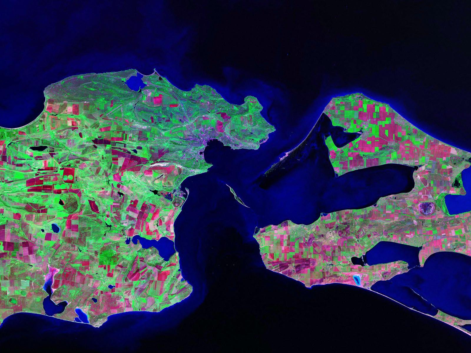
Landsat satellite (false color) photo of Kerch Strait between the Sea of Azov and the Black Sea.
Source:zulu.ssc.nasa.gov
[edit] Licensing
|
|
This file is in the public domain because it was created by NASA. NASA copyright policy states that "NASA material is not protected by copyright unless noted". (NASA copyright policy page or JPL Image Use Policy).
Deutsch | English | Español | Français | Nederlands | Português | Русский | 中文(简体) | 中文(繁體) | +/- |
|
 |
Warnings:
|
Historique du fichier
Cliquer sur une date et une heure pour voir le fichier tel qu’il était à ce moment-là
| Date et heure | Dimensions | Utilisateur | Commentaire | |
|---|---|---|---|---|
| actuel | 17 octobre 2006 à 15:52 | 1 600×1 200 (294 Kio) | Balcer | (Landsat satellite (false color) photo of Kerch Strait between the Sea of Azov and the Black Sea. Source:zulu.ssc.nasa.gov Category:Black Sea Category:Satellite pictures of Russia Category:Satellite pictures of Ukraine) |
Pages contenant l’image
Les pages ci-dessous contiennent cette image :

