Image:Karte Oscarsborg.png
Un article de Wikipédia, l'encyclopédie libre.
Taille de cet aperçu : 471 × 600 pixels
Image en plus haute résolution (570 × 726 pixels, taille du fichier : 173 Kio, type MIME : image/png)
| | Ce fichier provient de Wikimedia Commons?. Les informations le concernant sont affichées ci-dessous (procédure). |
[edit] Summary
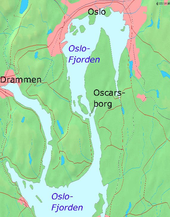
- Map of the Oslofjord and the fortress of Oscarsborg
- Source of Map: [1]
[edit] Licensing

Historique du fichier
Cliquer sur une date et une heure pour voir le fichier tel qu’il était à ce moment-là
| Date et heure | Dimensions | Utilisateur | Commentaire | |
|---|---|---|---|---|
| actuel | 7 avril 2005 à 21:23 | 570×726 (173 Kio) | Markus Schweiss | (Map refined with help of a norwegian wikipedian and his nautical chart of this area, sent by E-Mail to me {{GFDL}}) |
| 4 avril 2005 à 06:32 | 570×726 (173 Kio) | Markus Schweiss | (Map correction {{GFDL}}) | |
| 3 avril 2005 à 22:48 | 570×726 (173 Kio) | Markus Schweiss | (Correction of the map, {{GFDL}}) | |
| 3 avril 2005 à 22:24 | 570×726 (173 Kio) | Markus Schweiss | (Map of the Oslofjord and the fortress of Oscarsborg, Source of Map: [http://www2.demis.nl/mapserver/mapper.asp] {{GFDL}} Category:Norwegian history) |
Pages contenant l’image
La page ci-dessous contient cette image :

