Image:IrishSeaReliefMap.jpg
Un article de Wikipédia, l'encyclopédie libre.
Pas de plus haute résolution disponible.
IrishSeaReliefMap.jpg (461 × 561 pixels, taille du fichier : 84 Kio, type MIME : image/jpeg)
| | Ce fichier provient de Wikimedia Commons?. Les informations le concernant sont affichées ci-dessous (procédure). |
| Description |
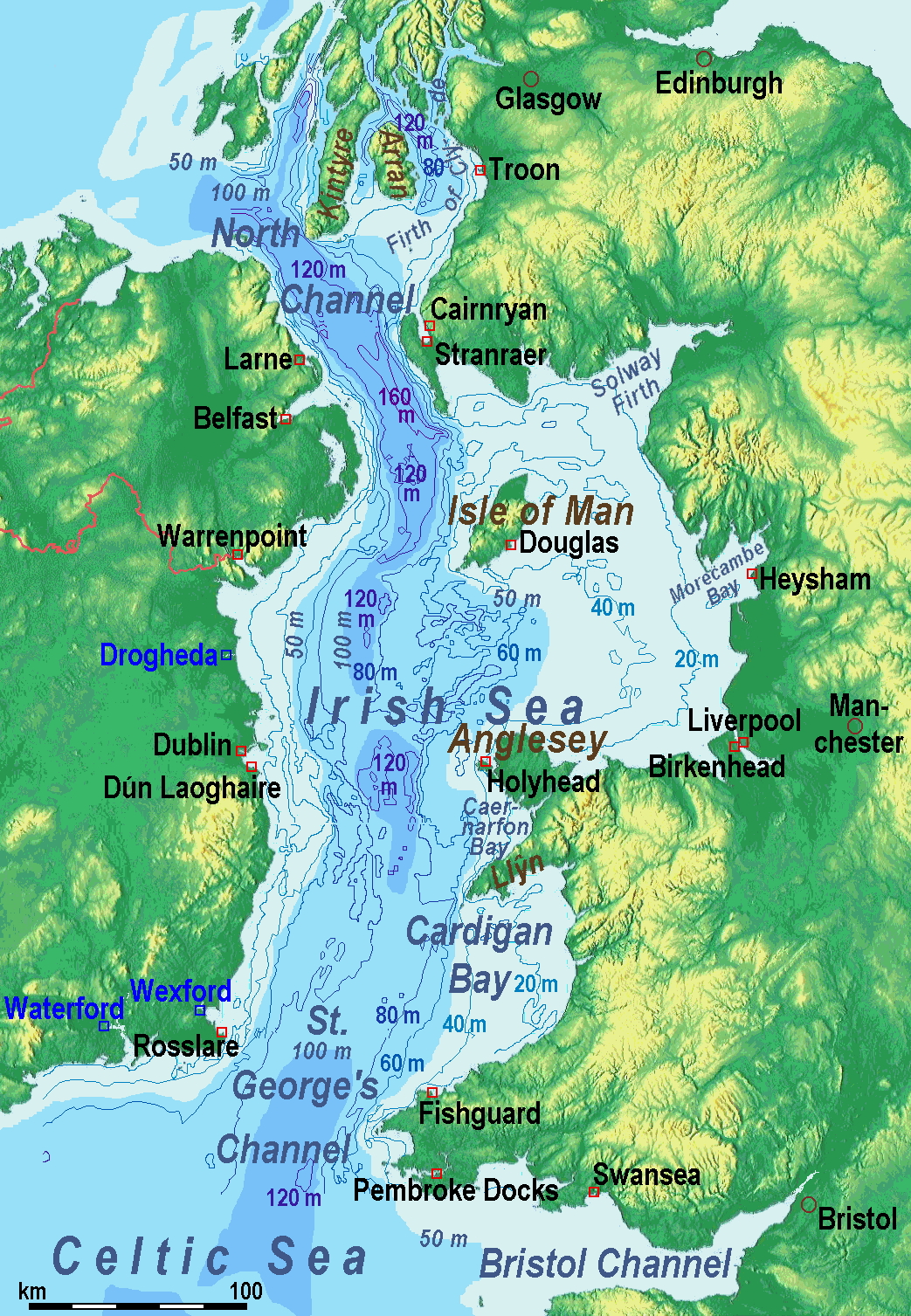
A map of the en:Irish Sea Major ports shown in red. freight only ports in blue. |
||
|---|---|---|---|
| Source | No source specified. Please edit this image description and provide a source. | ||
| Date | |||
| Author |
Users SFC9394, Seabhcan on en.wikipedia |
||
| Permission (Reusing this image) |
|
||
| Other versions |
Originally from en.wikipedia; description page is (was) here
|
(Uploaded using CommonsHelper or PushForCommons)
Historique du fichier
Cliquer sur une date et une heure pour voir le fichier tel qu’il était à ce moment-là
| Date et heure | Dimensions | Utilisateur | Commentaire | |
|---|---|---|---|---|
| actuel | 1 novembre 2006 à 11:01 | 461×561 (84 Kio) | Korrigan | ({{Information| |Description= A map of the en:Irish Sea Major ports shown in red. freight only ports in blue. |Source= |Date= |Author=Users SFC9394, Seabhcan on [http://en.wikipedia.org en.wikipedia] |Permiss) |
Pages contenant l’image
Les pages ci-dessous contiennent cette image :

