Image:Invasion of the Philippines, 1941.jpg
Un article de Wikipédia, l'encyclopédie libre.
Taille de cet aperçu : 367 × 599 pixels
Image en plus haute résolution (655 × 1 069 pixels, taille du fichier : 152 Kio, type MIME : image/jpeg)
| | Ce fichier provient de Wikimedia Commons?. Les informations le concernant sont affichées ci-dessous (procédure). |
| Description |
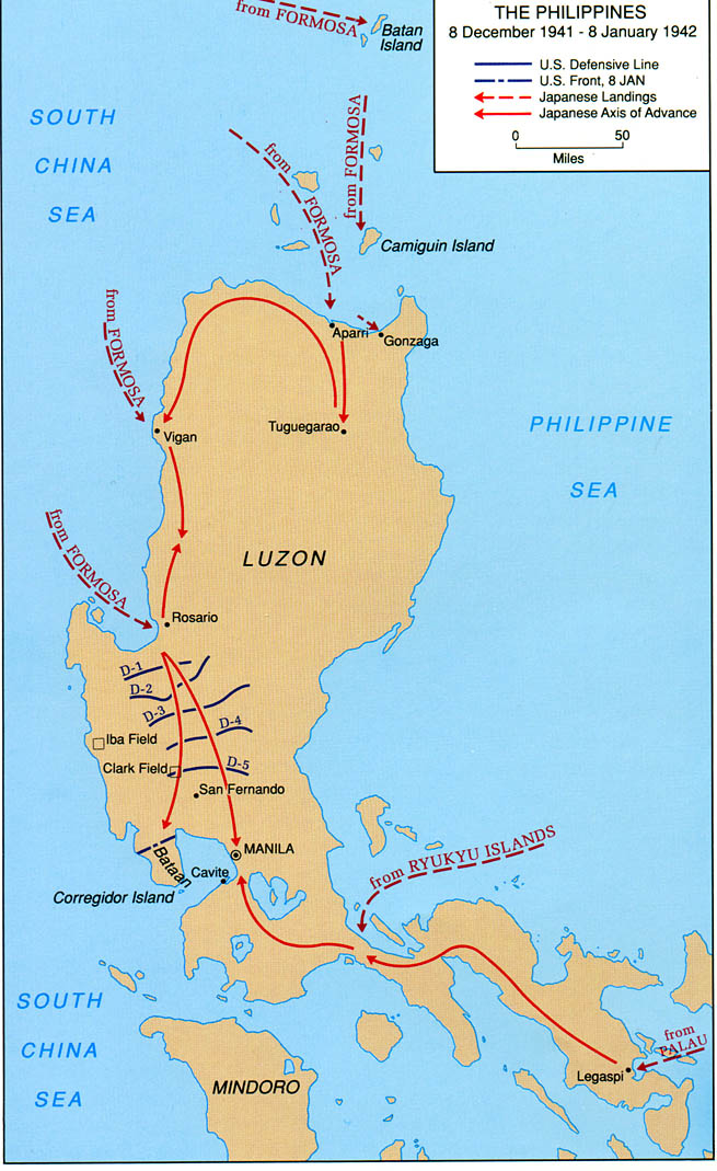
Map of Luzon, Philippines showing Japanese landings and advances from 8 December 1941 to 8 January 1942. |
|||
|---|---|---|---|---|
| Source | ||||
| Date | ||||
| Author | ||||
| Permission (Reusing this image) |
|

Historique du fichier
Cliquer sur une date et une heure pour voir le fichier tel qu’il était à ce moment-là
| Date et heure | Dimensions | Utilisateur | Commentaire | |
|---|---|---|---|---|
| actuel | 26 septembre 2007 à 22:53 | 655×1 069 (152 Kio) | Wwoods | ({{Information |Description= Map of Luzon, Philippines showing Japanese landings and advances from 8 December 1941 to 8 January 1942. |Source= http://www.army.mil/cmh-pg/brochures/pi/PI.htm |Date= |Author= |Permission= {{PD-USGov-Military-Army-USACMH}} |ot) |
Pages contenant l’image
La page ci-dessous contient cette image :

