Image:International E Road Network green.png
Un article de Wikipédia, l'encyclopédie libre.
Taille de cet aperçu : 800 × 571 pixels
Image en plus haute résolution (840 × 600 pixels, taille du fichier : 38 Kio, type MIME : image/png)
| | Ce fichier provient de Wikimedia Commons?. Les informations le concernant sont affichées ci-dessous (procédure). |
[edit] Description
| Description |
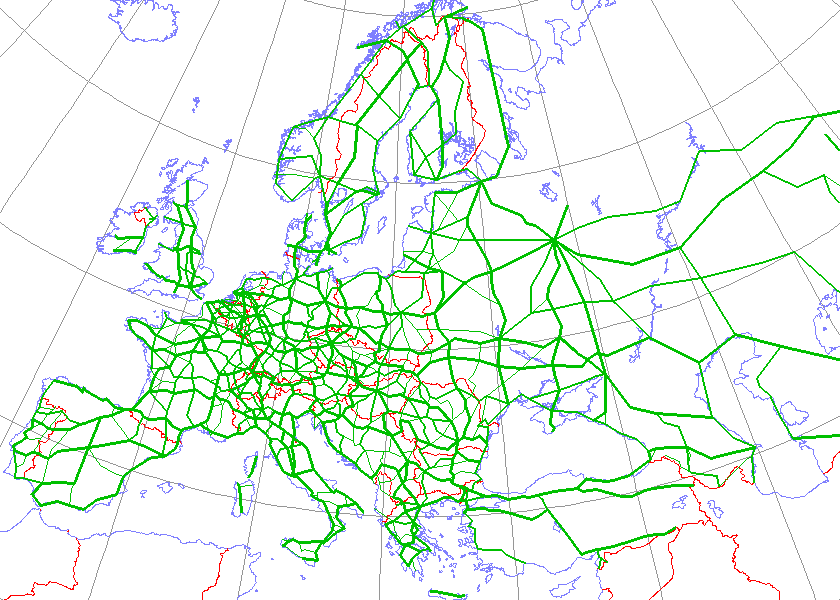
English: Map generated using coastline/boundary data from World Data Bank, and locations from http://www.world-gazetteer.com/. Straight lines connect control cities, no attempt to follow the real road. Roads color has been changed to green.
|
|---|---|
| Source |
http://en.wikipedia.org/wiki/Image:International_E_Road_Network.png |
| Date | |
| Author |
Kjhskj75 |
| Permission (Reusing this image) |
see below |
[edit] Licensing
| I, the copyright holder of this work, hereby release it into the public domain. This applies worldwide. In case this is not legally possible: Afrikaans | Alemannisch | Aragonés | العربية | Asturianu | Български | Català | Česky | Cymraeg | Dansk | Deutsch | Eʋegbe | Ελληνικά | English | Español | Esperanto | Euskara | Estremeñu | فارسی | Français | Galego | 한국어 | हिन्दी | Hrvatski | Ido | Bahasa Indonesia | Íslenska | Italiano | עברית | Kurdî / كوردی | Latina | Lietuvių | Latviešu | Magyar | Македонски | Bahasa Melayu | Nederlands | Norsk (bokmål) | Norsk (nynorsk) | 日本語 | Polski | Português | Ripoarisch | Română | Русский | Shqip | Slovenčina | Slovenščina | Српски / Srpski | Svenska | ไทย | Tagalog | Türkçe | Українська | Tiếng Việt | Walon | 中文(简体) | 中文(繁體) | zh-yue-hant | +/- |
Historique du fichier
Cliquer sur une date et une heure pour voir le fichier tel qu’il était à ce moment-là
| Date et heure | Dimensions | Utilisateur | Commentaire | |
|---|---|---|---|---|
| actuel | 13 mai 2008 à 18:09 | 840×600 (38 Kio) | Jklamo | (Albania update) |
| 22 décembre 2007 à 14:07 | 840×600 (39 Kio) | BIL | (== Description == {{Information |Description=Map generated using coastline/boundary data from World Data Bank, and locations from www.world-gazetteer.com. Straight lines connect control cities, no attempt to follow the real road. Roads color has been chan) | |
| 7 octobre 2007 à 22:03 | 840×600 (33 Kio) | The RedBurn | (All e-roads in green.) | |
| 7 octobre 2007 à 21:55 | 840×600 (34 Kio) | The RedBurn | ({{Information |Description=Map generated using coastline/boundary data from World Data Bank, and locations from www.world-gazetteer.com. Straight lines connect control cities, no attempt to follow the real road. Roads color has been changed to green. |Sou) |
Pages contenant l’image
La page ci-dessous contient cette image :

