Image:Indonesia 2002 CIA map.jpg
Un article de Wikipédia, l'encyclopédie libre.
Taille de cet aperçu : 800 × 536 pixels
Image en plus haute résolution (2 000 × 1 340 pixels, taille du fichier : 1,43 Mio, type MIME : image/jpeg)
| | Ce fichier provient de Wikimedia Commons?. Les informations le concernant sont affichées ci-dessous (procédure). |
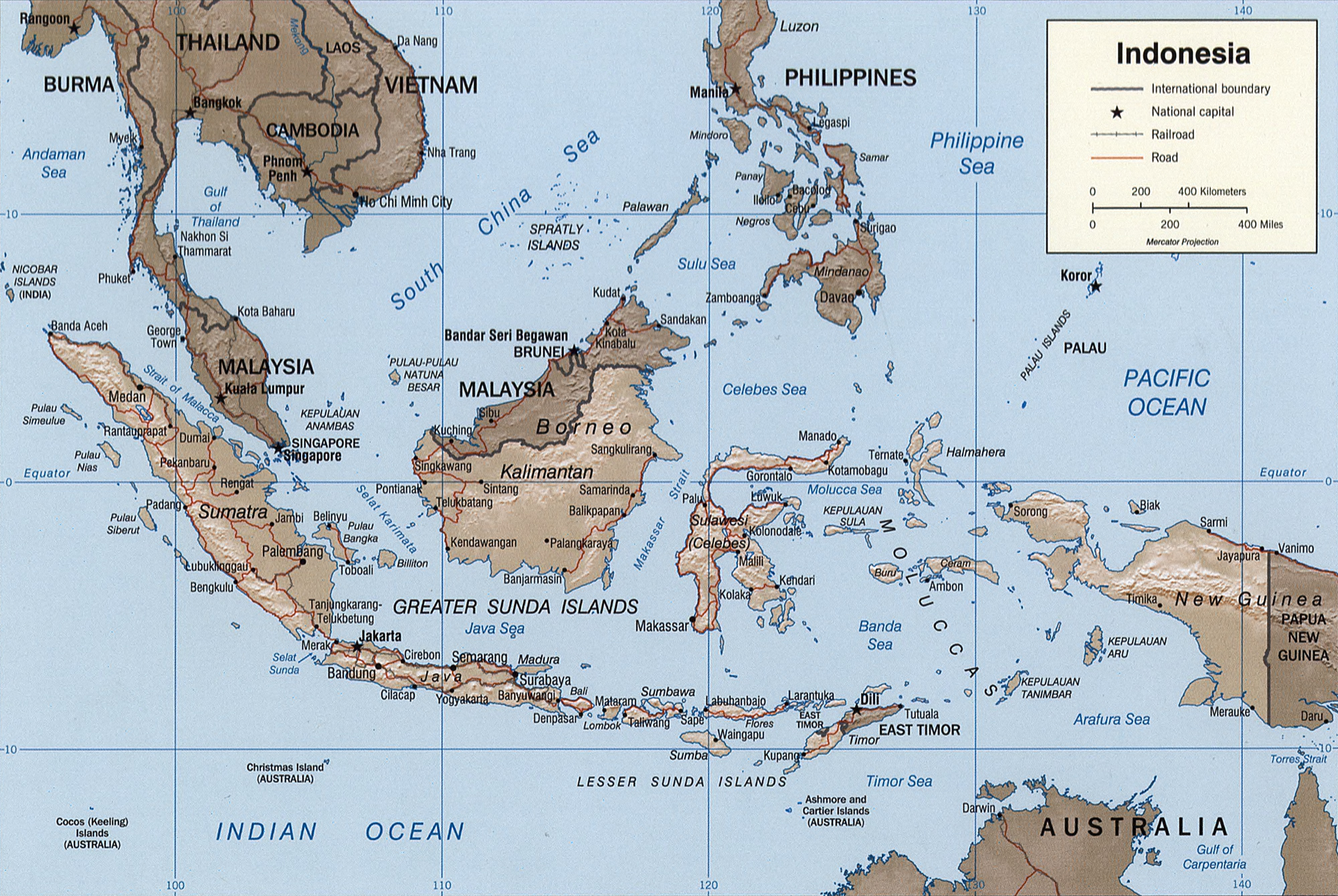
Indonesia.
United States. Central Intelligence Agency.
CREATED/PUBLISHED [Washington, D.C. : Central Intelligence Agency, 2002]
NOTES Relief shown by shading.
"Base 802899AI (C00429) 11-02."
Also issued without shaded relief.
Scale [ca. 1:25,000,000] ; Mercator proj. (E 1040--E 1430/N 170--S 150).
SUBJECTS Indonesia--Maps. Indonesia.
MEDIUM 1 map : col. ; 16 x 23 cm.
CALL NUMBER G8070 2002 .U6
REPOSITORY Library of Congress Geography and Map Division Washington, D.C. 20540-4650 USA
DIGITAL ID g8070 ct000982 http://hdl.loc.gov/loc.gmd/g8070.ct000982
| This image is a work of a Central Intelligence Agency employee, taken or made during the course of the person's official duties. As a Work of the United States Government, all images created or made by the CIA are in the public domain, with the exception of classified information. |  |
Historique du fichier
Cliquer sur une date et une heure pour voir le fichier tel qu’il était à ce moment-là
| Date et heure | Dimensions | Utilisateur | Commentaire | |
|---|---|---|---|---|
| actuel | 26 octobre 2005 à 05:39 | 2 000×1 340 (1,43 Mio) | Brian0918 | (Indonesia. United States. Central Intelligence Agency. CREATED/PUBLISHED [Washington, D.C. : Central Intelligence Agency, 2002] NOTES Relief shown by shading. "Base 802899AI (C00429) 11-02." Also issued without shaded relief. Scale [ca. 1:25,000,000) |
Pages contenant l’image
Les pages ci-dessous contiennent cette image :
Métadonnées
Ce fichier contient des informations supplémentaires probablement ajoutées par l’appareil photo numérique ou le numériseur qui l’a acquis. Si le fichier a été modifié depuis son état original, certains détails peuvent ne pas refléter entièrement l’image modifiée.
| Largeur | 3208 |
|---|---|
| Hauteur | 2468 |
| Type de compression | Non compressé |
| Modèle colorimétrique | RGB |
| Orientation | Normale |
| Composantes par pixel | 3 |
| Résolution horizontale | 72 dpi |
| Résolution verticale | 72 dpi |
| Logiciel utilisé | Adobe Photoshop CS2 Windows |
| Date de modification | 25 octobre 2005 à 23:38 |
| Espace colorimétrique | 65535 |

