Image:Hungary with Turky in Europe.jpg
Un article de Wikipédia, l'encyclopédie libre.
Taille de cet aperçu : 731 × 600 pixels
Image en plus haute résolution (2 676 × 2 196 pixels, taille du fichier : 288 Kio, type MIME : image/jpeg)
| | Ce fichier provient de Wikimedia Commons?. Les informations le concernant sont affichées ci-dessous (procédure). |
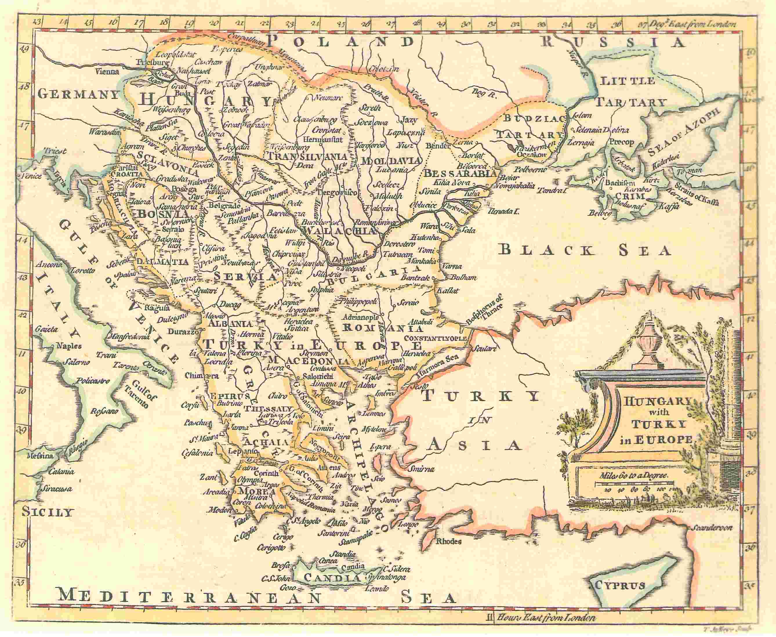
A map by T. Jefferys, 1785
The map shows Hungary and the bordering Balkan regions controlled by the Ottoman Empire.
The owner of the map agrees to the image being displayed in Wikipedia. All other ways of using this image should be disussed with User:KIDB
| This image (or other media file) is in the public domain because its copyright has expired. This applies to the United States, Canada, the European Union and those countries with a copyright term of life of the author plus 70 years.
العربية | Asturianu | Български | Català | Česky | Dansk | Deutsch | English | Ελληνικά | Esperanto | Español | Euskara | فارسی | Français | Gaeilge | Galego | עברית | हिन्दी | Bahasa Indonesia | Italiano | 日本語 | 한국어 | Kurdî / كوردی | Lietuvių | Magyar | Nederlands | Norsk (nynorsk) | Македонски | Bahasa Melayu | Polski | Português | Română | Русский | Slovenčina | Slovenščina | Shqip | Suomi | Sámegiella | Türkçe | 中文(简体) | 中文(繁體) | 粵語 | +/- |
This image was (or all images in this article or category were) uploaded in the JPEG format.
However, it contains information that could be stored more efficiently or more accurately in the PNG format or SVG format. If possible, please upload a PNG or SVG version of this image without compression artifacts, derived from a non-JPEG source or with existing artifacts removed. After doing so, please:
- Find all pages in all Wikimedia projects that use this image, and replace the old image with the new image in each.
- Mark this image as having been superseded by adding one of these templates.
Deutsch | English | Español | Français | 日本語 | Português | Русский | +/-
[{Category:Facsimile maps|Ottoman]]
Historique du fichier
Cliquer sur une date et une heure pour voir le fichier tel qu’il était à ce moment-là
| Date et heure | Dimensions | Utilisateur | Commentaire | |
|---|---|---|---|---|
| actuel | 20 novembre 2006 à 00:00 | 2 676×2 196 (288 Kio) | Electionworld | ('''A map by T. Jefferys, 1785''' <br><br> The map shows Hungary and the bordering Balkan regions controlled by the Ottoman Empire. <br><br> ''The owner of the map agrees to the image being displayed in Wikipedia. All other ways of using this image should ) |
Pages contenant l’image
Les pages ci-dessous contiennent cette image :

