Image:Hugo 1989 track.png
Un article de Wikipédia, l'encyclopédie libre.
Taille de cet aperçu : 800 × 495 pixels
Image en plus haute résolution (1 024 × 633 pixels, taille du fichier : 272 Kio, type MIME : image/png)
| | Ce fichier provient de Wikimedia Commons?. Les informations le concernant sont affichées ci-dessous (procédure). |
[edit] Summary
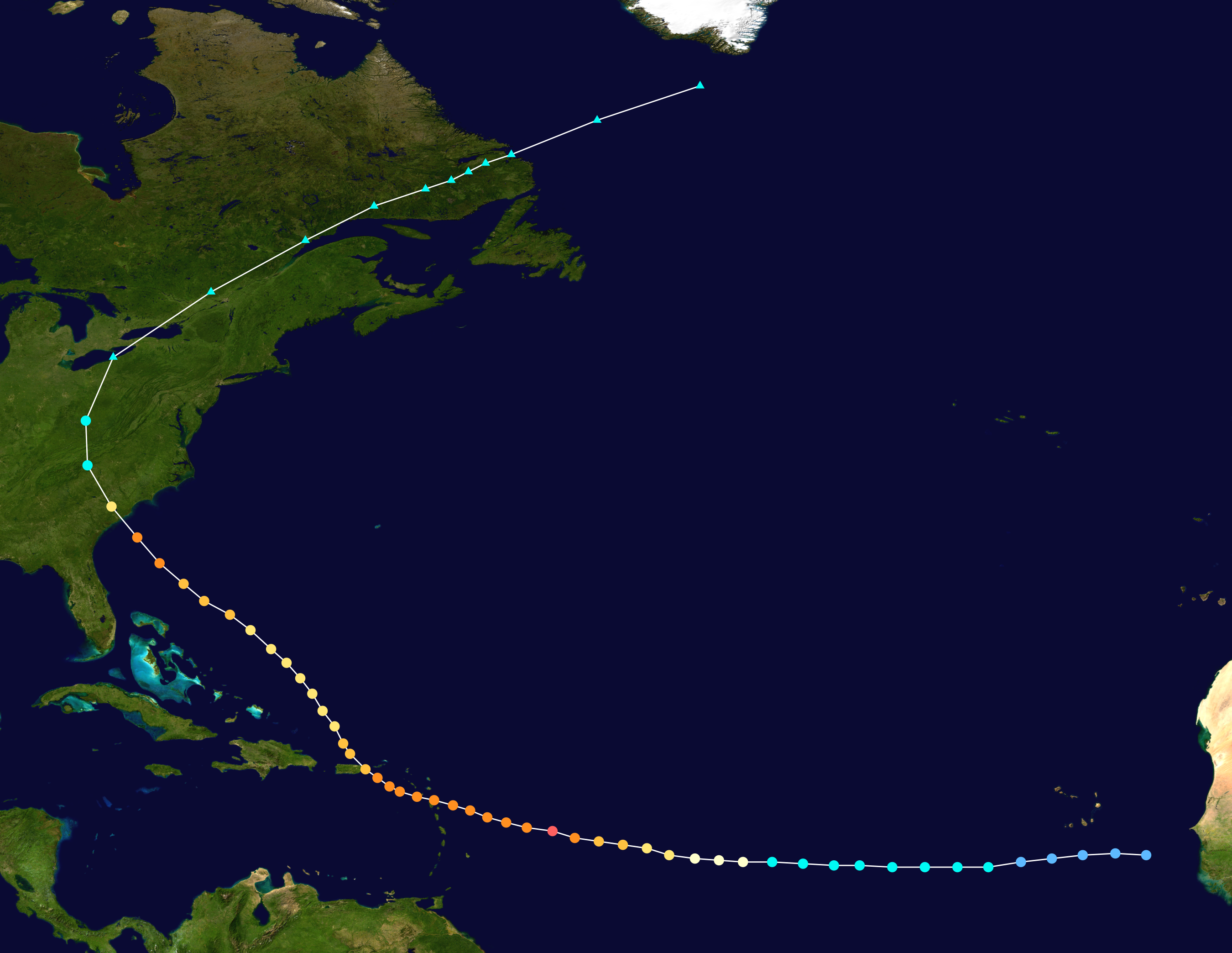
Hurricane Hugo (1989) track. Uses the color scheme from the Saffir-Simpson Hurricane Scale.
[edit] Licensing
Created using Wikipedia:WikiProject Tropical cyclones/Tracks. The background image is from NASA. Tracking data from the National Hurricane Center.[1]
| I, the copyright holder of this work, hereby release it into the public domain. This applies worldwide. In case this is not legally possible: Afrikaans | Alemannisch | Aragonés | العربية | Asturianu | Български | Català | Česky | Cymraeg | Dansk | Deutsch | Eʋegbe | Ελληνικά | English | Español | Esperanto | Euskara | Estremeñu | فارسی | Français | Galego | 한국어 | हिन्दी | Hrvatski | Ido | Bahasa Indonesia | Íslenska | Italiano | עברית | Kurdî / كوردی | Latina | Lietuvių | Latviešu | Magyar | Македонски | Bahasa Melayu | Nederlands | Norsk (bokmål) | Norsk (nynorsk) | 日本語 | Polski | Português | Ripoarisch | Română | Русский | Shqip | Slovenčina | Slovenščina | Српски / Srpski | Svenska | ไทย | Tagalog | Türkçe | Українська | Tiếng Việt | Walon | 中文(简体) | 中文(繁體) | zh-yue-hant | +/- |
Historique du fichier
Cliquer sur une date et une heure pour voir le fichier tel qu’il était à ce moment-là
| Date et heure | Dimensions | Utilisateur | Commentaire | |
|---|---|---|---|---|
| actuel | 13 juillet 2006 à 17:14 | 1 024×633 (272 Kio) | Nilfanion | |
| 12 novembre 2005 à 03:06 | 1 024×633 (273 Kio) | Jdorje | ({{Hurricane auto track map|Hurricane Hugo (1989)}}) |
Pages contenant l’image
Les pages ci-dessous contiennent cette image :

