Image:Galveston island 0001.png
Un article de Wikipédia, l'encyclopédie libre.
Pas de plus haute résolution disponible.
Galveston_island_0001.png (534 × 566 pixels, taille du fichier : 34 Kio, type MIME : image/png)
| | Ce fichier provient de Wikimedia Commons?. Les informations le concernant sont affichées ci-dessous (procédure). |
| Description |
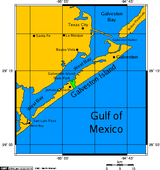
English: A map of en:Galveston Island, a en:barrier island on the en:Texas Gulf coast in the en:United States, about 50 miles (80 kilometers) south of the city of Houston. The map was created with this online map creation tool.
|
|---|---|
| Source |
Transfered from en.wikipedia Transfer was stated to be made by User:PaulVIF. |
| Date |
2006-01-12 (original upload date) |
| Author |
Original uploader was Kharker at en.wikipedia |
| Permission (Reusing this image) |
GFDL-SELF-WITH-DISCLAIMERS; Released under the GNU Free Documentation License. |
[edit] License information

|
[edit] Original upload log
The original description page is/was here. All following user names refer to en.wikipedia.
- 2006-01-12 21:50 Kharker 534×566×8 (34675 bytes) A map of [[Galveston Island]], a [[barrier island]] on the [[Texas]] Gulf coast in the [[United States]], about 50 miles (80 kilometers) south of the city of [[Houston, Texas|Houston]]. The map was created with this [http://www.aquarius.geomar.de/omc/ on
Historique du fichier
Cliquer sur une date et une heure pour voir le fichier tel qu’il était à ce moment-là
| Date et heure | Dimensions | Utilisateur | Commentaire | |
|---|---|---|---|---|
| actuel | 22 décembre 2007 à 12:07 | 534×566 (34 Kio) | PaulVIF | ({{Information |Description={{en|A map of en:Galveston Island, a en:barrier island on the en:Texas Gulf coast in the en:United States, about 50 miles (80 kilometers) south of the city of Houston. The map was crea) |
Pages contenant l’image
Les pages ci-dessous contiennent cette image :

