Image:Extratropical formation areas.jpg
Un article de Wikipédia, l'encyclopédie libre.
Taille de cet aperçu : 800 × 400 pixels
Image en plus haute résolution (1 999 × 1 000 pixels, taille du fichier : 525 Kio, type MIME : image/jpeg)
| | Ce fichier provient de Wikimedia Commons?. Les informations le concernant sont affichées ci-dessous (procédure). |
| Description |
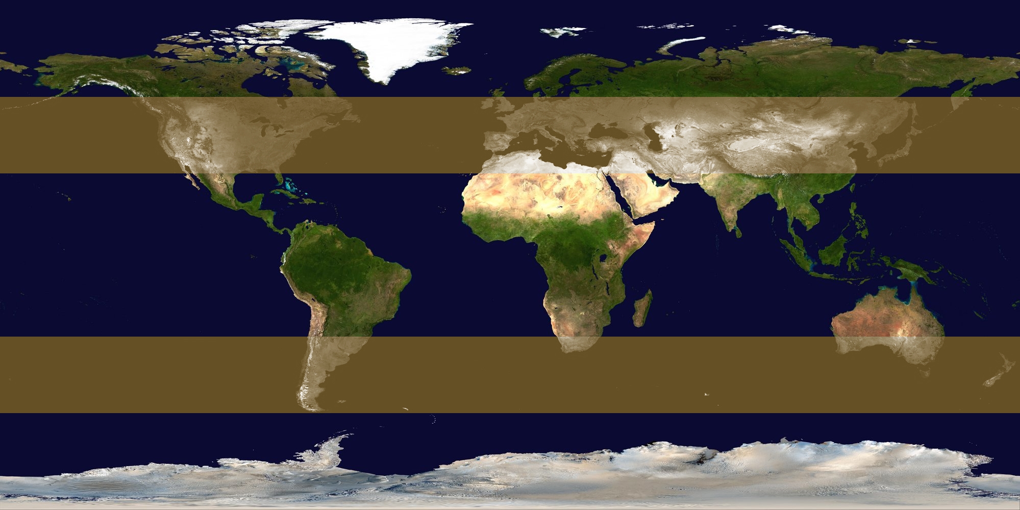
Image identifying extratropical cyclone formation areas, between approximately 30° and 60° N/S latitude. |
||
|---|---|---|---|
| Source |
background: Image:Whole world - land and oceans 12000.jpg, edit by me |
||
| Date |
2006-10-23 |
||
| Author | |||
| Permission (Reusing this image) |
|
Historique du fichier
Cliquer sur une date et une heure pour voir le fichier tel qu’il était à ce moment-là
| Date et heure | Dimensions | Utilisateur | Commentaire | |
|---|---|---|---|---|
| actuel | 23 octobre 2006 à 19:25 | 1 999×1 000 (525 Kio) | Titoxd | ({{information | description = Image identifying w:extratropical cyclone formation areas, between approximately 30° and 60° N/S w:latitude. | source = background: Image:Whole world - land and oceans 12000.jpg, edit by me | date = 2006-10) |
Pages contenant l’image
La page ci-dessous contient cette image :

