Image:Extent of territorial control in sri lanka.png
Un article de Wikipédia, l'encyclopédie libre.
Taille de cet aperçu : 375 × 599 pixels
Image en plus haute résolution (601 × 960 pixels, taille du fichier : 243 Kio, type MIME : image/png)
| | Ce fichier provient de Wikimedia Commons?. Les informations le concernant sont affichées ci-dessous (procédure). |
[edit] Licensing

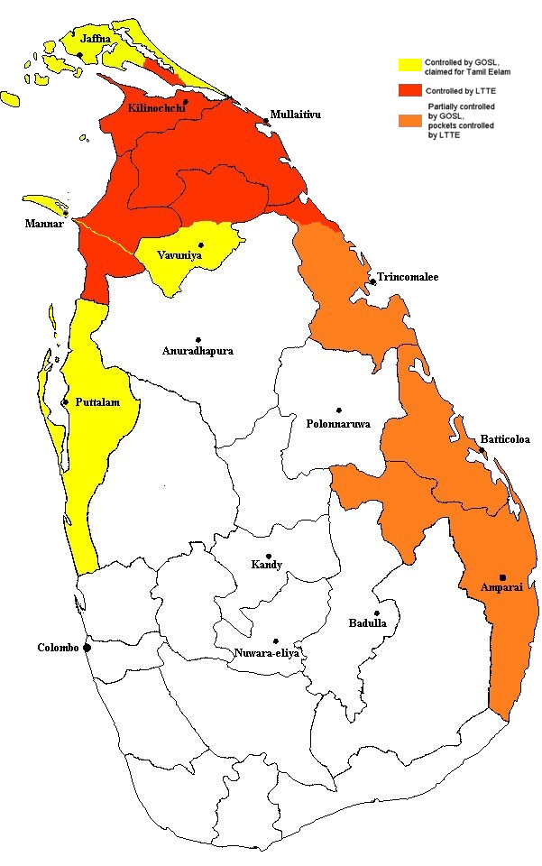
According to the creator, the source was a humanitarian aid decision by the EU (reference no. ECHO/-SA/BUD/2005/02000, available online at http://ec.europa.eu/echo/pdf_files/decisions/2005/dec_sa_02000.pdf).
Historique du fichier
Cliquer sur une date et une heure pour voir le fichier tel qu’il était à ce moment-là
| Date et heure | Dimensions | Utilisateur | Commentaire | |
|---|---|---|---|---|
| actuel | 29 décembre 2005 à 00:19 | 601×960 (243 Kio) | Vadakkan | (This map approximately shows the areas of Sri Lanka controlled by the LTTE and the Government, as of December 2005. The information as to areas of control was taken from a report issued by the European Union. The map was originally uploaded to :en by [[:e) |
Pages contenant l’image
Les pages ci-dessous contiennent cette image :

