Image:El ruiz volcano.jpg
Un article de Wikipédia, l'encyclopédie libre.
Taille de cet aperçu : 800 × 599 pixels
Image en plus haute résolution (2 288 × 1 712 pixels, taille du fichier : 1,62 Mio, type MIME : image/jpeg)
| | Ce fichier provient de Wikimedia Commons?. Les informations le concernant sont affichées ci-dessous (procédure). |
[edit] Summary
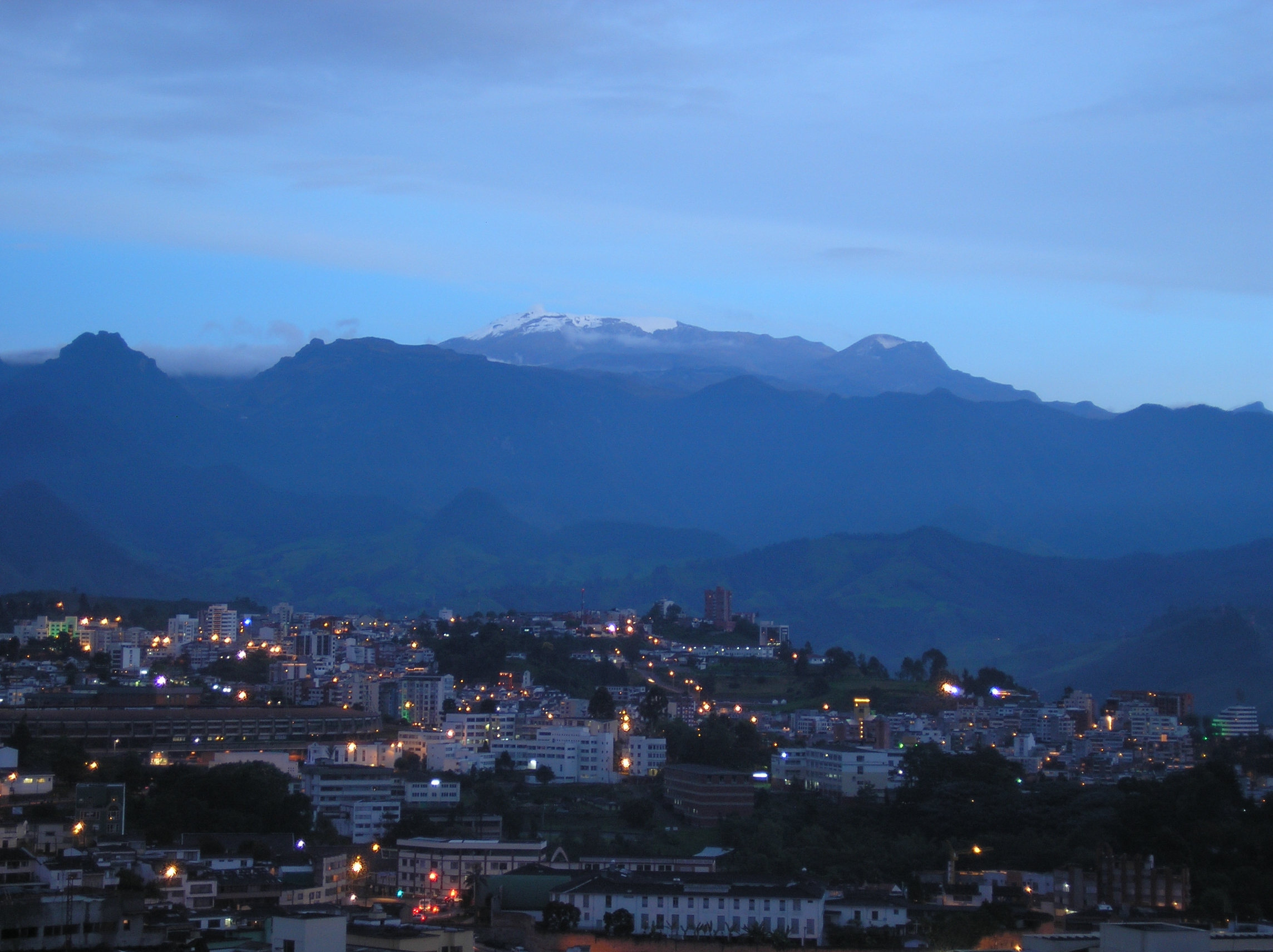
"El Nevado del Ruiz" (El Ruiz snow peak). Part of Los Nevados National Park. This picture was taken on December 27, 2006 (from Manizales City) at around 6:30 pm local time. 20 years ago, snow used to cover the mountain peak and the volcano. To the left of the mountain you can still see some smoke coming out of the Arenas crater, which points to the other side of the Los Andes mountain range. It exploded in 1985 burying the 25000-people city of Armero in the middle of the night. However, it remains as one of the most beautiful natural attractions not only of Manizales, but Colombia.
[edit] Licensing
| I, the copyright holder of this work, hereby release it into the public domain. This applies worldwide. In case this is not legally possible: Afrikaans | Alemannisch | Aragonés | العربية | Asturianu | Български | Català | Česky | Cymraeg | Dansk | Deutsch | Eʋegbe | Ελληνικά | English | Español | Esperanto | Euskara | Estremeñu | فارسی | Français | Galego | 한국어 | हिन्दी | Hrvatski | Ido | Bahasa Indonesia | Íslenska | Italiano | עברית | Kurdî / كوردی | Latina | Lietuvių | Latviešu | Magyar | Македонски | Bahasa Melayu | Nederlands | Norsk (bokmål) | Norsk (nynorsk) | 日本語 | Polski | Português | Ripoarisch | Română | Русский | Shqip | Slovenčina | Slovenščina | Српски / Srpski | Svenska | ไทย | Tagalog | Türkçe | Українська | Tiếng Việt | Walon | 中文(简体) | 中文(繁體) | zh-yue-hant | +/- |
Historique du fichier
Cliquer sur une date et une heure pour voir le fichier tel qu’il était à ce moment-là
| Date et heure | Dimensions | Utilisateur | Commentaire | |
|---|---|---|---|---|
| actuel | 21 janvier 2007 à 03:28 | 2 288×1 712 (1,62 Mio) | Foj333 | ("El Nevado del Ruiz" (El Ruiz snow peak). Part of the Los Nevados National Park. I took this picture on December 27, 2006 at around 6:30 pm local time. 20 years ago the snow covered the peak and the volcano. To the left of the mountain you can still see s) |
Pages contenant l’image
La page ci-dessous contient cette image :
Métadonnées
Ce fichier contient des informations supplémentaires probablement ajoutées par l’appareil photo numérique ou le numériseur qui l’a acquis. Si le fichier a été modifié depuis son état original, certains détails peuvent ne pas refléter entièrement l’image modifiée.
| Fabricant de l’appareil | OLYMPUS IMAGING CORP. |
|---|---|
| Modèle de l’appareil | X550,D545Z,C480Z |
| Temps d’exposition | 13/10 sec (1.3) |
| Ouverture | f/4.2 |
| Date de la prise originelle | 31 juillet 2006 à 06:09 |
| Longueur focale | 14 mm |
| Description de l’image | OLYMPUS DIGITAL CAMERA |
| Orientation | Normale |
| Résolution horizontale | 72 dpi |
| Résolution verticale | 72 dpi |
| Logiciel utilisé | Version 1.0 |
| Date de modification | 31 juillet 2006 à 06:09 |
| Positionnement YCbCr | 2 |
| Programme d’exposition | Programme création (préférence à la profondeur de champ) |
| Sensibilité ISO | 50 |
| Version EXIF | 2.21 |
| Date de la numérisation | 31 juillet 2006 à 06:09 |
| Mode de compression de l’image | 5 |
| Correction d’exposition | 0 |
| Ouverture maximale | 2.97 |
| Mode de mesure | Modèle |
| Source de lumière | Inconnue |
| Flash | 16 |
| Espace colorimétrique | sRGB |
| Rendu personnalisé | Procédé normal |
| Mode d’exposition | Automatique |
| Balance des blancs | Automatique |
| Taux de zoom numérique | 0 |
| Type de capture de la scène | Scène de nuit |
| Contraste | Normal |
| Saturation | Normale |
| Netteté | Normale |

