Image:Duchy of Courland & Semigallia 1740.svg
Un article de Wikipédia, l'encyclopédie libre.

Duchy_of_Courland_&_Semigallia_1740.svg (Fichier SVG, résolution de 1074 × 945 pixels, taille : 510 Kio)
| | Ce fichier provient de Wikimedia Commons?. Les informations le concernant sont affichées ci-dessous (procédure). |
Contents |
[edit] Summary
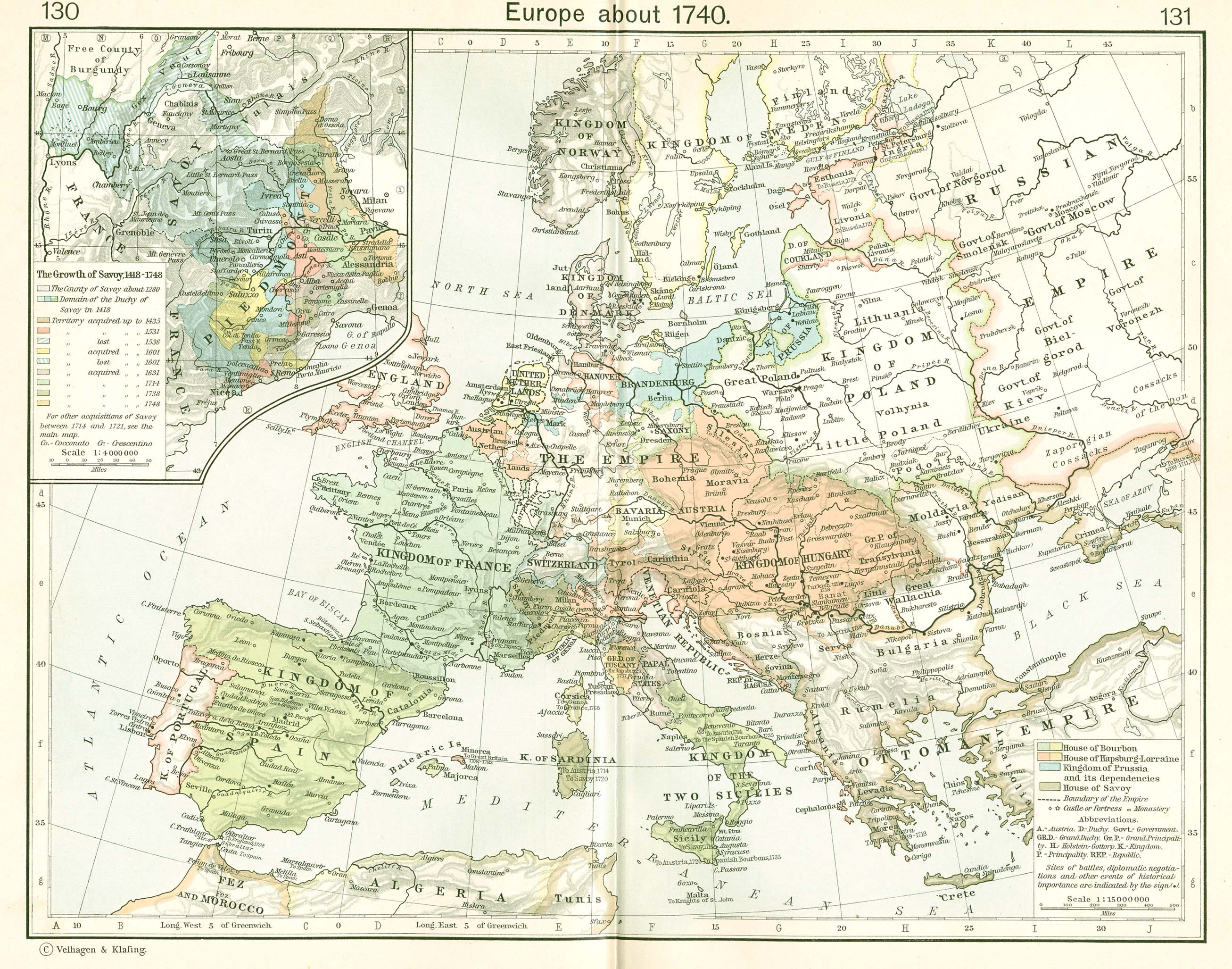
lv: Kurzemes un Zemgales Hercogiste 1740.
en: The Duchy of Courland and Semigallia in 1740.
pl: Księstwo Kurlandii i Semigalii w 1740 roku.
The towns and cities are designated by their German names since the nobility and the Duke were of German heritage. The rivers, somewhat incongruously, are given their common Latvian names.
This map uses a Mercator projection.
[edit] References
The basic map was developed from Shepherd:
- Shepherd, William R., (1911), "Europe, 1740" in Historical Atlas, p. 131.
Modifications were made based on other resources including:
- Hammond Historical World Atlas, Hammond World Atlas Corporation, (2000).
[edit] Other versions
- no text (locator map)
- English language
- Latvian language
[edit] Licensing

Historique du fichier
Cliquer sur une date et une heure pour voir le fichier tel qu’il était à ce moment-là
| Date et heure | Dimensions | Utilisateur | Commentaire | |
|---|---|---|---|---|
| actuel | 24 janvier 2007 à 19:27 | 1 074×945 (510 Kio) | MapMaster | (upgraded) |
| 24 janvier 2007 à 03:55 | 1 074×945 (510 Kio) | MapMaster | (made some improvements based on feedback from our Lithuanian editors) | |
| 21 janvier 2007 à 17:16 | 1 074×945 (498 Kio) | MapMaster | (A map of the Duchy of Courland and Semigallia in 1740) |
Pages contenant l’image
Les pages ci-dessous contiennent cette image :

