Image:DEMAoste.png
Un article de Wikipédia, l'encyclopédie libre.
Taille de cet aperçu : 800 × 539 pixels
Image en plus haute résolution (2 895 × 1 952 pixels, taille du fichier : 4,78 Mio, type MIME : image/png)
| | Ce fichier provient de Wikimedia Commons?. Les informations le concernant sont affichées ci-dessous (procédure). |
[edit] Summary
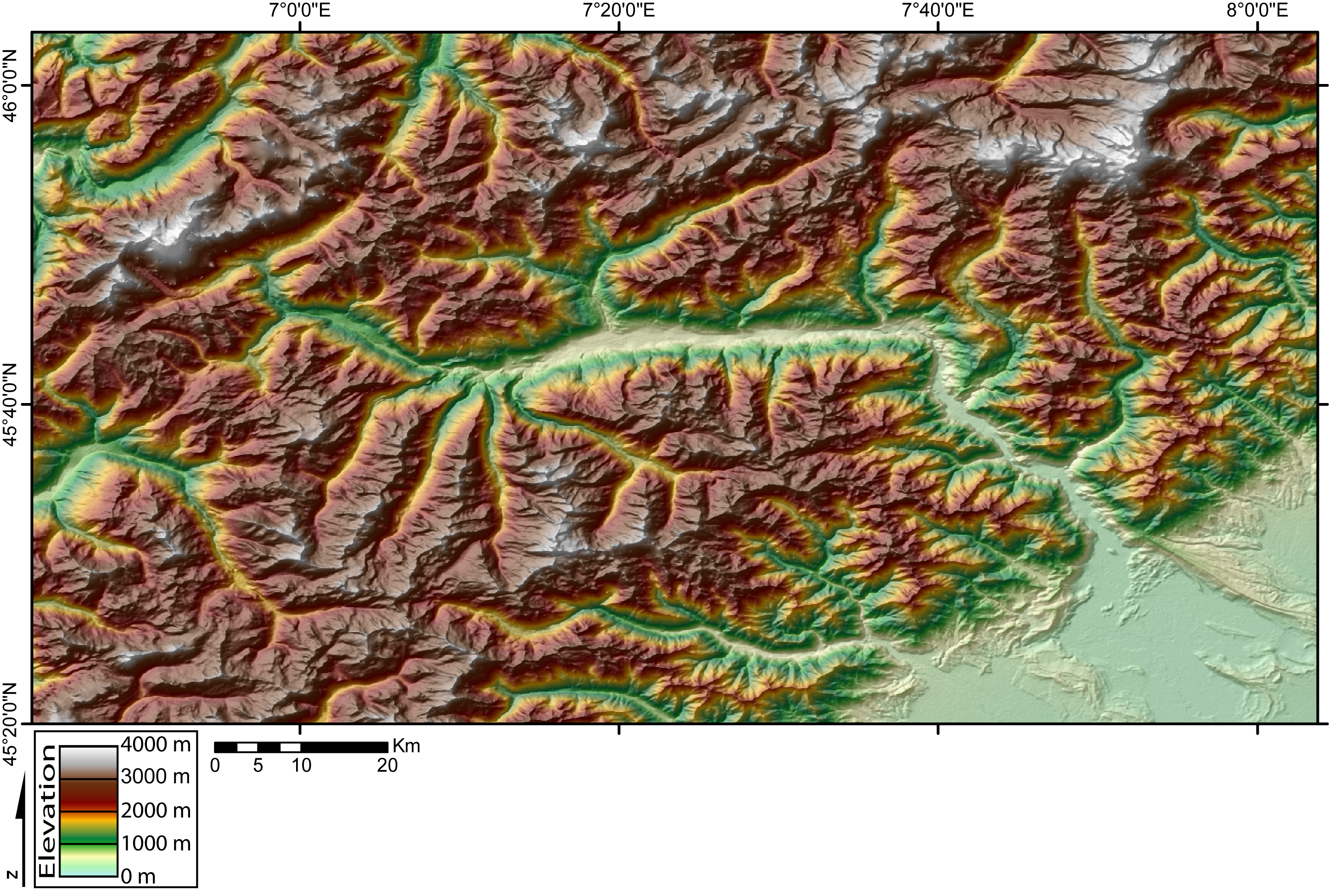
DEM of the Val d'Aosta (W Italian Alps) created by Jide from the 90m pixel size SRTM dataset. The Dora Baltea river runs in the Aosta Valley from the West (Mont Blanc massif) to the East (Po plain).
[edit] Licensing

Historique du fichier
Cliquer sur une date et une heure pour voir le fichier tel qu’il était à ce moment-là
| Date et heure | Dimensions | Utilisateur | Commentaire | |
|---|---|---|---|---|
| actuel | 11 novembre 2005 à 22:27 | 2 895×1 952 (4,78 Mio) | Jide | (DEM of the Val d'Aosta (W Italian Alps) created by Jide from the 90m pixel size SRTM dataset. The Dora Baltea river runs in the Aosta Valley from the West (Mont Blanc massif) to the East (Po plain).) |
Pages contenant l’image
Les pages ci-dessous contiennent cette image :

