Image:Crete-Johnston-1861.png
Un article de Wikipédia, l'encyclopédie libre.
Taille de cet aperçu : 800 × 397 pixels
Image en plus haute résolution (1 830 × 907 pixels, taille du fichier : 2,93 Mio, type MIME : image/png)
| | Ce fichier provient de Wikimedia Commons?. Les informations le concernant sont affichées ci-dessous (procédure). |
[edit] Summary
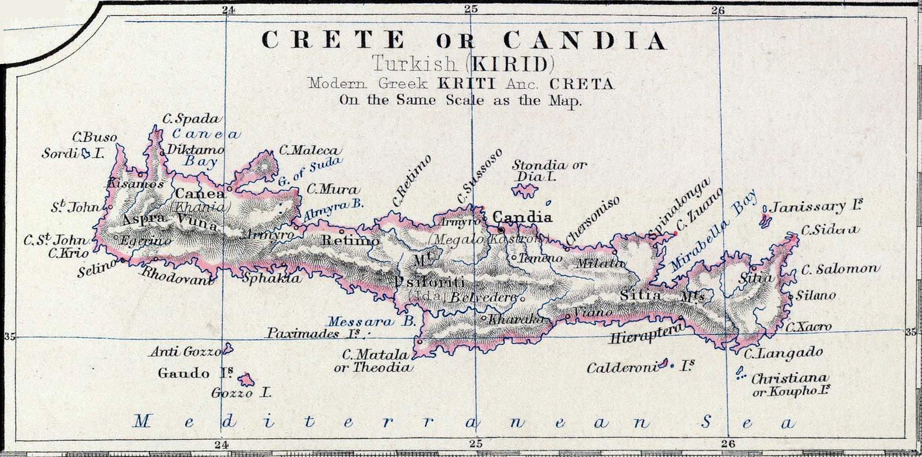
| Description |
Map Crete or Candia part of map Turkey in Europe |
|---|---|
| Source |
Keith Johnston's General Atlas, p. 22, published by William Blackwood & Sons, Edinburgh & London |
| Date |
1861 |
| Author |
Johnston, Alexander Keith, 1804-1871 |
| Permission (Reusing this image) |
Public Domain |
[edit] Licensing
| This image (or other media file) is in the public domain because its copyright has expired. This applies to the United States, Canada, the European Union and those countries with a copyright term of life of the author plus 70 years.
العربية | Asturianu | Български | Català | Česky | Dansk | Deutsch | English | Ελληνικά | Esperanto | Español | Euskara | فارسی | Français | Gaeilge | Galego | עברית | हिन्दी | Bahasa Indonesia | Italiano | 日本語 | 한국어 | Kurdî / كوردی | Lietuvių | Magyar | Nederlands | Norsk (nynorsk) | Македонски | Bahasa Melayu | Polski | Português | Română | Русский | Slovenčina | Slovenščina | Shqip | Suomi | Sámegiella | Türkçe | 中文(简体) | 中文(繁體) | 粵語 | +/- |
Historique du fichier
Cliquer sur une date et une heure pour voir le fichier tel qu’il était à ce moment-là
| Date et heure | Dimensions | Utilisateur | Commentaire | |
|---|---|---|---|---|
| actuel | 17 novembre 2006 à 00:38 | 1 830×907 (2,93 Mio) | Bejnar | ({{Information |Description=Map ''Crete or Candia'' part of map ''Turkey in Europe'' |Source=Keith Johnston's General Atlas, p. 22, published by William Blackwood & Sons, Edinburgh & London |Date=1861 |Author=Johnston, Alexander Keith, 1804-1871 |Permiss) |
| 17 novembre 2006 à 00:35 | 1 830×907 (2,41 Mio) | Bejnar | ({{Information |Description=Map ''Crete or Candia'' part of map ''Turkey in Europe'' |Source=Keith Johnston's General Atlas, p. 22, published by William Blackwood & Sons, Edinburgh & London |Date=1861 |Author=Johnston, Alexander Keith, 1804-1871 |Permiss) |
Pages contenant l’image
La page ci-dessous contient cette image :

