Image:Cities of Tierra del Fuego.png
Un article de Wikipédia, l'encyclopédie libre.
Pas de plus haute résolution disponible.
Cities_of_Tierra_del_Fuego.png (519 × 475 pixels, taille du fichier : 21 Kio, type MIME : image/png)
| | Ce fichier provient de Wikimedia Commons?. Les informations le concernant sont affichées ci-dessous (procédure). |
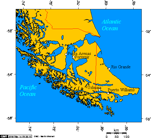
English: Cities of Tierra del Fuego
Esperanto: Urboj de Fuegio
Español: Ciudades de Tierra del Fuego

This map is taken from en:Image:Cities of Tierra del Fuego.png and was created with this online map creation tool. Uploaded by en:User:Geo Swan on 14 March 2005.
The longitude and latitude of the cities follow:
- -70.9333,-53.1666,Punta Arenas
- -70.3648,-53.2959,Porvenir
- -67.6167,-54.9333,Puerto Williams
- -68.2978,-54.7921,Ushuaia
- -67.5982,-53.8114,Rio Grande
Historique du fichier
Cliquer sur une date et une heure pour voir le fichier tel qu’il était à ce moment-là
| Date et heure | Dimensions | Utilisateur | Commentaire | |
|---|---|---|---|---|
| actuel | 6 octobre 2005 à 13:47 | 519×475 (21 Kio) | ChongDae | (This image was copied from wikipedia:en. The original description was: Cities of Tierra del Fuego {{GFDL}} This map was created with this [http://www.aquarius.geomar.de/omc/ online map creation tool]. The longitude and latitude of the cities follow: *-) |
| 24 avril 2005 à 12:46 | 519×475 (21 Kio) | Poulpy | (Cities of Tierra del Fuego {{GFDL}} This map is taken from en:Image:Cities of Tierra del Fuego.png and was created with this [http://www.aquarius.geomar.de/omc/ online map creation tool]. The longitude and latitude of the cities follow: *-70.9333,-) |
Pages contenant l’image
Les pages ci-dessous contiennent cette image :

