Image:Chornobyl radiation map.jpg
Un article de Wikipédia, l'encyclopédie libre.
Taille de cet aperçu : 556 × 600 pixels
Image en plus haute résolution (1 070 × 1 154 pixels, taille du fichier : 237 Kio, type MIME : image/jpeg)
| | Ce fichier provient de Wikimedia Commons?. Les informations le concernant sont affichées ci-dessous (procédure). |
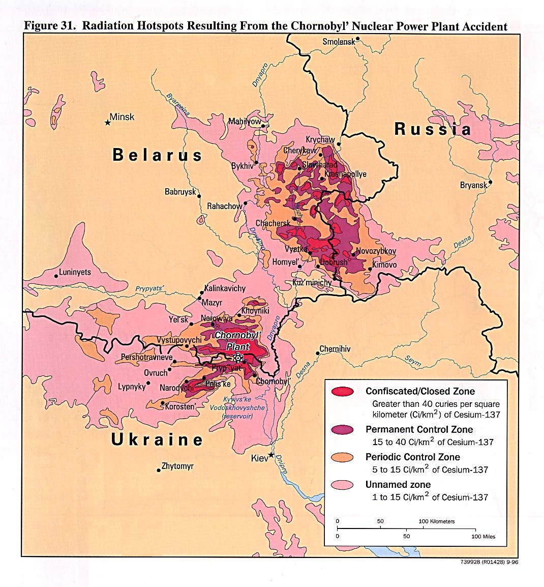
"Courtesy of the University of Texas Libraries, The University of Texas at Austin."
See [1]; from the CIA Handbook of International Economic Statistics. 1996
切尔诺贝利核电站事故后周边地区受到核辐射的剂量示意图。
[edit] Other versions
[edit]
 Original JPEG from CIA Handbook |
 Deutsch |
 English |
 Esperanto |
 Español |
 Français (original SVG) |
 Italiano |
 Русский |
[edit] Google Earth
|
|
View this map positioned as an overlay in Google Earth. |

| This image is a work of a Central Intelligence Agency employee, taken or made during the course of the person's official duties. As a Work of the United States Government, all images created or made by the CIA are in the public domain, with the exception of classified information. |  |
Historique du fichier
Cliquer sur une date et une heure pour voir le fichier tel qu’il était à ce moment-là
| Date et heure | Dimensions | Utilisateur | Commentaire | |
|---|---|---|---|---|
| actuel | 25 décembre 2005 à 23:32 | 1 070×1 154 (237 Kio) | Redline | ("Courtesy of the University of Texas Libraries, The University of Texas at Austin." See [http://www.lib.utexas.edu/maps/belarus.html]; from the CIA Handbook of International Economic Statistics. 1996 {{PD-USGov}}) |
Pages contenant l’image
Les pages ci-dessous contiennent cette image :

