Image:Ceram tpc 1967.jpg
Un article de Wikipédia, l'encyclopédie libre.

Taille de cet aperçu : 800 × 399 pixels
Image en plus haute résolution (2 374 × 1 185 pixels, taille du fichier : 364 Kio, type MIME : image/jpeg)
| | Ce fichier provient de Wikimedia Commons?. Les informations le concernant sont affichées ci-dessous (procédure). |
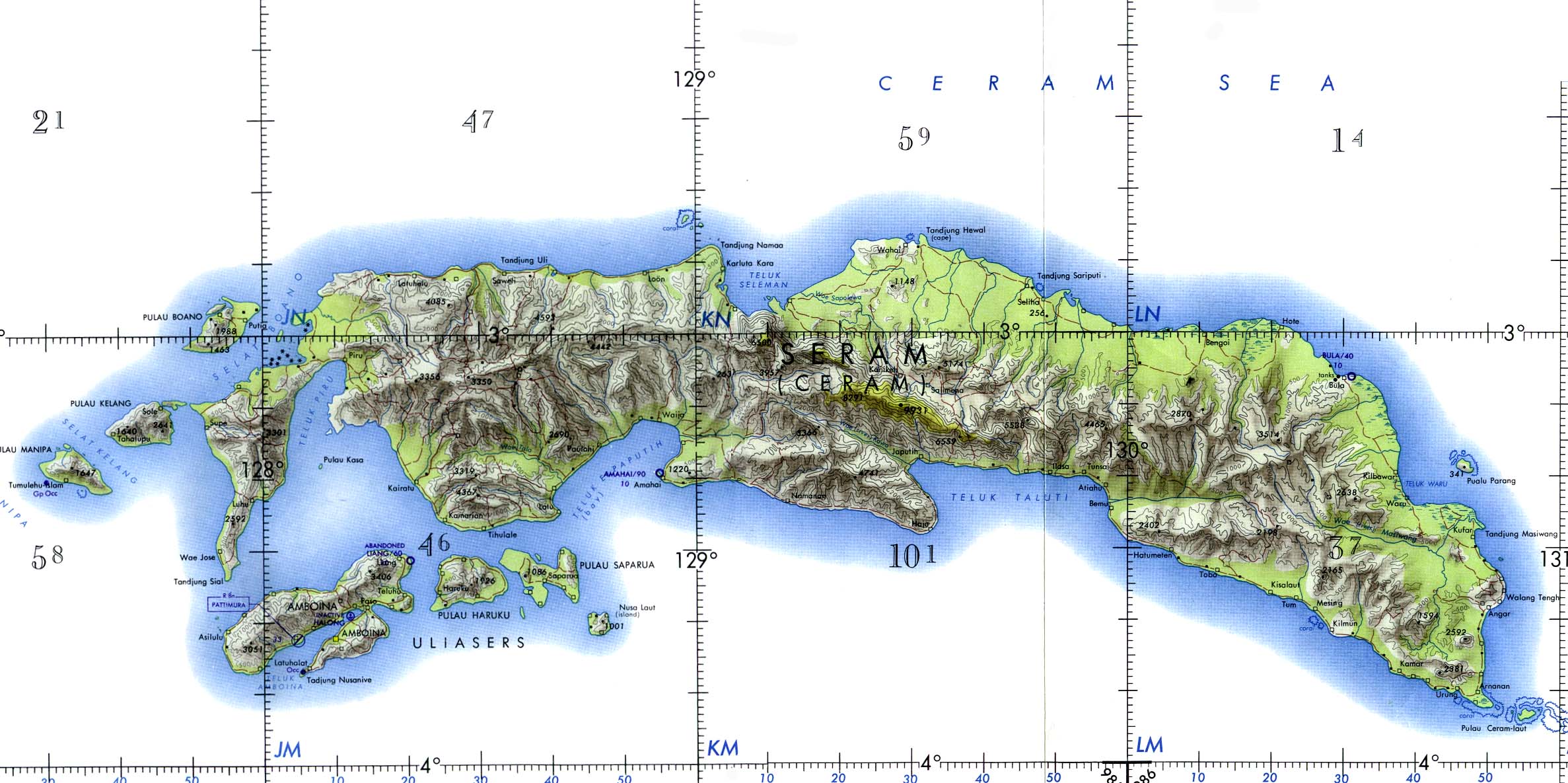
Ceram and Ambon Islands (Operational Navigation Chart) original scale 1:1,000,000. Portion of Defense Mapping Agency ONC M-12 1967 (372K) Not for navigational use
nb: Seram; formerly Ceram, also called Seran or Serang.
Courtesy of the University of Texas Libraries, The University of Texas at Austin.
From the Perry-Castañeda Library Map Collection:
http://www.lib.utexas.edu/maps/middle_east_and_asia/ceram_tpc_1967.jpg
Library Web Material Usage Statement at:
http://www.lib.utexas.edu/usage_statement.html
| This work is in the public domain in the United States because it is a work of the United States Federal Government under the terms of Title 17, Chapter 1, Section 105 of the US Code. See Copyright.
Note: This only applies to works of the Federal Government and not to the work of any individual U.S. state, territory, commonwealth, county, municipality, or any other subdivision. العربية | Български | Česky | Deutsch | English | Español | Français | Magyar | Italiano | 日本語 | 한국어 | Polski | Português | 中文(繁體) | 中文(简体) | +/- |
 |
Historique du fichier
Cliquer sur une date et une heure pour voir le fichier tel qu’il était à ce moment-là
| Date et heure | Dimensions | Utilisateur | Commentaire | |
|---|---|---|---|---|
| actuel | 25 janvier 2005 à 12:47 | 2 374×1 185 (364 Kio) | Dionysos | (Ceram) |
Pages contenant l’image
Les pages ci-dessous contiennent cette image :

