Image:CapeHornDetailMap.png
Un article de Wikipédia, l'encyclopédie libre.
Taille de cet aperçu : 800 × 482 pixels
Image en plus haute résolution (906 × 546 pixels, taille du fichier : 91 Kio, type MIME : image/png)
| | Ce fichier provient de Wikimedia Commons?. Les informations le concernant sont affichées ci-dessous (procédure). |
[edit] Summary
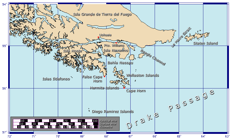
Español: Detalle de las islas cerca del Cabo de Hornos
A map showing the location of Cape Horn, including part of the Drake Passage.
Generated using GMT.
[edit] Licensing

Historique du fichier
Cliquer sur une date et une heure pour voir le fichier tel qu’il était à ce moment-là
| Date et heure | Dimensions | Utilisateur | Commentaire | |
|---|---|---|---|---|
| actuel | 9 février 2006 à 14:22 | 906×546 (91 Kio) | Johantheghost | (Less violent colours.) |
| 28 janvier 2006 à 02:25 | 906×546 (90 Kio) | Johantheghost | (Fix scale!) | |
| 27 janvier 2006 à 22:20 | 906×546 (87 Kio) | Johantheghost | (Scale and false cape) | |
| 27 janvier 2006 à 18:34 | 906×546 (81 Kio) | Johantheghost | (A map showing the location of Cape Horn, including part of the Drake Passage. Generated using [http://gmt.soest.hawaii.edu/ GMT]. ) |
Pages contenant l’image
Les pages ci-dessous contiennent cette image :

