Image:C77190s1 Ant.Map Ross Island.jpg
Un article de Wikipédia, l'encyclopédie libre.
Taille de cet aperçu : 800 × 508 pixels
Image en plus haute résolution (5 118 × 3 249 pixels, taille du fichier : 1,95 Mio, type MIME : image/jpeg)
| | Ce fichier provient de Wikimedia Commons?. Les informations le concernant sont affichées ci-dessous (procédure). |
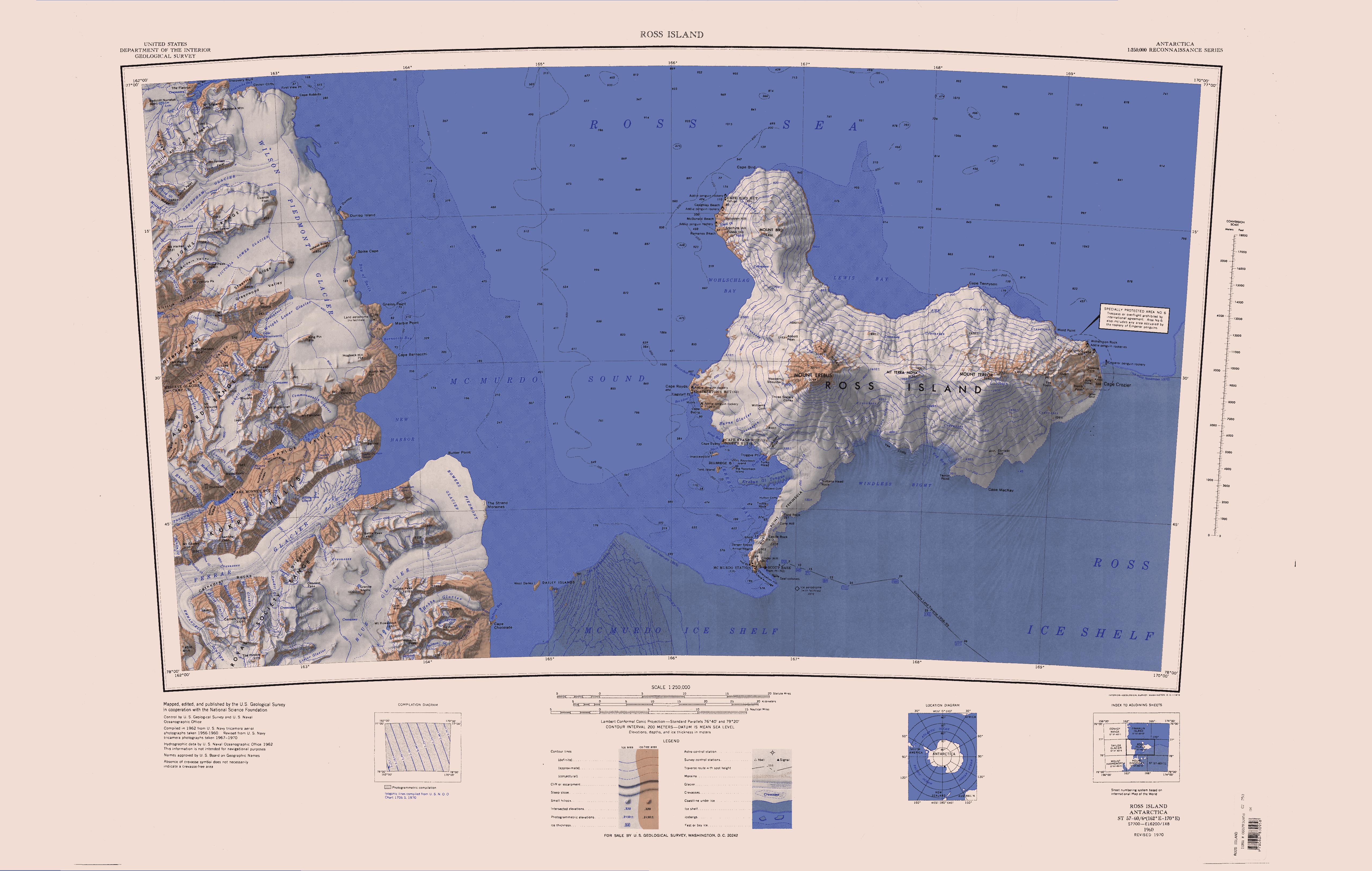
Map of Antarctica by the United States Antarctic Ressource Center of the US Geological Society.
|
|
This media file is in the public domain in the United States. This applies to U.S. works where the copyright has expired, often because its first publication occurred prior to January 1, 1923. See this page for further explanation.
|
|
|
Deutsch | English | Español | Français | Gaeilge | Galego | Italiano | Nederlands | 中文(简体) | +/- |
||
|
|
This image might not be in the public domain outside of the United States (this especially applies in Canada, China (not Hong Kong, Macao, or Taiwan Area), Germany, Mexico, and Switzerland). The creator and year of publication are essential information and must be provided. See Wikipedia:Public domain and Wikipedia:Copyrights for more details. |
Copyrights and Trademarks USGS-authored or produced data and information are in the public domain. While the content of most USGS web pages is in the public domain, not all the information on our site is in the public domain. Some images/graphics are used by USGS with permission. For other uses, you may need to obtain permission from the copyright holder under the copyright law. You are welcome to make a link to any of the Web pages USGS has published on the Internet. There is no need to request permission. The USGS identifier is trademarked and must be used in accordance with the rules outlined at Visual Identity System. Information on who may use the USGS identifier and how to obtain a copy of it is available at Use of the Trademarked USGS Identifier by Outside Organizations. We will identify material we use from sources outside of USGS, and request others do the same when using information published by USGS. Credit can be provided by including on the page (or via a link to a credits page) a citation such as: Credit: U. S. Geological Survey U. S. Geological Survey/photo by Jane Doe (if the artist is known) USGS/Ft. Collins, CO (if originating office but not the artist is known)
Historique du fichier
Cliquer sur une date et une heure pour voir le fichier tel qu’il était à ce moment-là
| Date et heure | Dimensions | Utilisateur | Commentaire | |
|---|---|---|---|---|
| actuel | 15 avril 2005 à 14:01 | 5 118×3 249 (1,95 Mio) | Achim Raschka | (Map of Antarctica by the United States Antarctic Ressource Center of the US Geological Society. {{PD-US}} Copyrights and Trademarks USGS-authored or produced data and information are in the public domain. While the content of most USGS web pages is in th) |
Pages contenant l’image
La page ci-dessous contient cette image :

