Image:BirdsHeadPeninsula Topo.jpg
Un article de Wikipédia, l'encyclopédie libre.
Taille de cet aperçu : 800 × 551 pixels
Image en plus haute résolution (837 × 576 pixels, taille du fichier : 76 Kio, type MIME : image/jpeg)
| | Ce fichier provient de Wikimedia Commons?. Les informations le concernant sont affichées ci-dessous (procédure). |
[edit] Beschreibung
| Description |
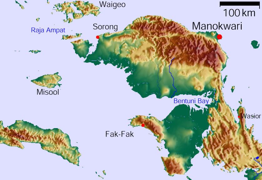
Vogelkop Peninsula, West Papua (Indonesia) |
|||
|---|---|---|---|---|
| Source |
own work. GMT, GLOBE |
|||
| Date |
January 2006 |
|||
| Author |
Stefan Faymer |
|||
| Permission (Reusing this image) |
|

Historique du fichier
Cliquer sur une date et une heure pour voir le fichier tel qu’il était à ce moment-là
| Date et heure | Dimensions | Utilisateur | Commentaire | |
|---|---|---|---|---|
| actuel | 7 janvier 2007 à 20:12 | 837×576 (76 Kio) | Faymer | (== Beschreibung == {{Information |Description=Vogelkop Peninsula, West Papua (Indonesia) |Source=own work. GMT, GLOBE |Date=January 2006 |Author=Stefan Faymer |Permission={{Bild-GFDL-GMT}} |other_versions= }} Category:West Irian Jaya) |
Pages contenant l’image
La page ci-dessous contient cette image :

