Image:Beneeden rivier de Maas.jpg
Un article de Wikipédia, l'encyclopédie libre.
Taille de cet aperçu : 800 × 424 pixels
Image en plus haute résolution (1 001 × 531 pixels, taille du fichier : 179 Kio, type MIME : image/jpeg)
| | Ce fichier provient de Wikimedia Commons?. Les informations le concernant sont affichées ci-dessous (procédure). |
| Description |
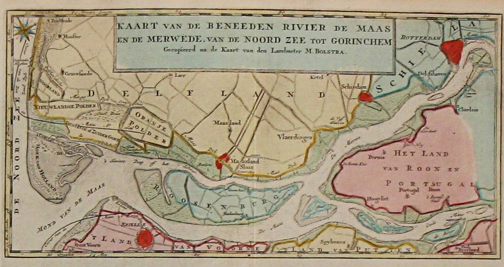
en: Mouth of the Meuse in 1769. Map of Izaak Tirion from 1769. |
|---|---|
| Source |
Originally from nl.wikipedia; description page is/was here. |
| Date |
2006-09-11 (original upload date) |
| Author |
Original uploader was Hanhil at nl.wikipedia |
| Permission (Reusing this image) |
PD-OUD. |
[edit] License information
| This image (or other media file) is in the public domain because its copyright has expired. This applies to the United States, Canada, the European Union and those countries with a copyright term of life of the author plus 70 years.
العربية | Asturianu | Български | Català | Česky | Dansk | Deutsch | English | Ελληνικά | Esperanto | Español | Euskara | فارسی | Français | Gaeilge | Galego | עברית | हिन्दी | Bahasa Indonesia | Italiano | 日本語 | 한국어 | Kurdî / كوردی | Lietuvių | Magyar | Nederlands | Norsk (nynorsk) | Македонски | Bahasa Melayu | Polski | Português | Română | Русский | Slovenčina | Slovenščina | Shqip | Suomi | Sámegiella | Türkçe | 中文(简体) | 中文(繁體) | 粵語 | +/- |
[edit] Original upload log
(All user names refer to nl.wikipedia)
- 2006-09-11 07:22 Hanhil 1001×531×8 (183061 bytes) Kaart van Izaak Tirion uit 1769
Historique du fichier
Cliquer sur une date et une heure pour voir le fichier tel qu’il était à ce moment-là
| Date et heure | Dimensions | Utilisateur | Commentaire | |
|---|---|---|---|---|
| actuel | 27 avril 2007 à 16:20 | 1 001×531 (179 Kio) | P199 | ({{Information |Description=Maasmonding in 1769. Kaart van Izaak Tirion uit 1769 |Source=Originally from [http://nl.wikipedia.org nl.wikipedia]; description page is/was [http://nl.wikipedia.org/w/index.php?title=Image%3ABeneeden_rivier_de_Maas.jpg here]. |) |
Pages contenant l’image
La page ci-dessous contient cette image :

