Image:Bavarian Circle-2005-10-15-en.png
Un article de Wikipédia, l'encyclopédie libre.
Taille de cet aperçu : 610 × 599 pixels
Image en plus haute résolution (727 × 714 pixels, taille du fichier : 67 Kio, type MIME : image/png)
| | Ce fichier provient de Wikimedia Commons?. Les informations le concernant sont affichées ci-dessous (procédure). |
This image was copied from wikipedia:fr. The original description was:
[edit] Sommaire
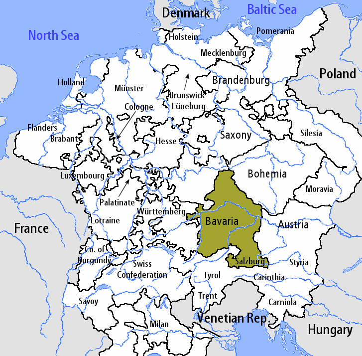
fr::en:User:Silverhelm is the author of this image file. Its contents are based in part on a map published in the "Historical Atlas" by Prof. William R Shepherd, pub. Henry Holt & Co. (New York, 1911).
[edit] Licence
| This file is licensed under Creative Commons Attribution ShareAlike 1.0 License |
fr:Catégorie:Cartes d'Allemagne
fr:en:Bavarian_Circle-2005-10-15-en.png
| date/time | username | resolution | size | edit summary |
|---|---|---|---|---|
Historique du fichier
Cliquer sur une date et une heure pour voir le fichier tel qu’il était à ce moment-là
| Date et heure | Dimensions | Utilisateur | Commentaire | |
|---|---|---|---|---|
| actuel | 7 août 2006 à 13:27 | 727×714 (67 Kio) | Loveless | (This image was copied from wikipedia:fr. The original description was: == Sommaire == fr::en:User:Silverhelm is the author of this image file. Its contents are based in part on a map published in the "Historical Atlas" by Prof. William R Shepherd, ) |
Pages contenant l’image
La page ci-dessous contient cette image :

