Image:Bassas da India atoll map-fr.png
Un article de Wikipédia, l'encyclopédie libre.
Taille de cet aperçu : 650 × 600 pixels
Image en plus haute résolution (1 555 × 1 435 pixels, taille du fichier : 329 Kio, type MIME : image/png)
| | Ce fichier provient de Wikimedia Commons?. Les informations le concernant sont affichées ci-dessous (procédure). |
[edit] Summary
| Camera location | This and other geocoded Commons images: | (Info) |
|---|
| Description |
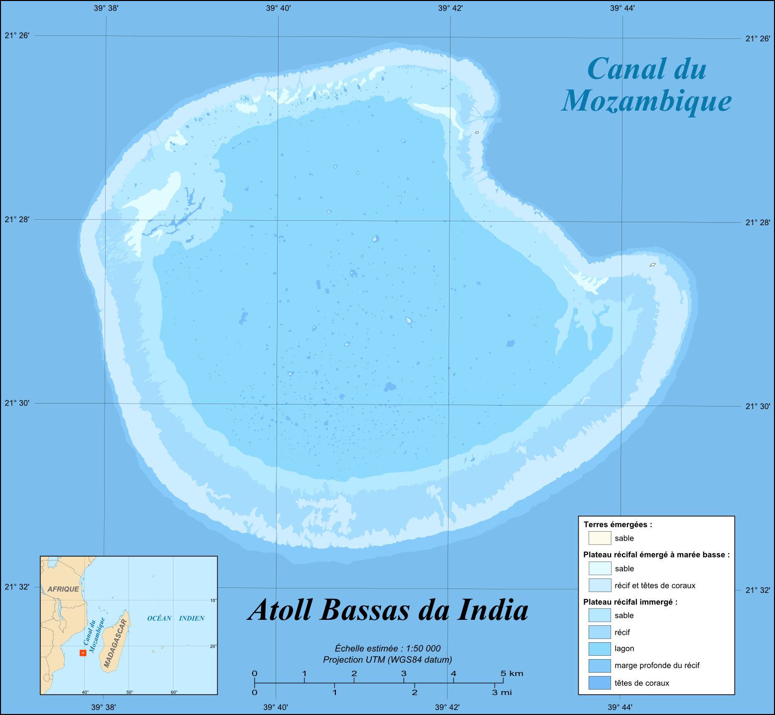
English: Map in French of the French atoll of Bassas da India, Scattered islands in the Indian Ocean.
Français : Carte en français de l'atoll français de Bassas da India, Îles Éparses.
|
||
|---|---|---|---|
| Source |
Own work |
||
| Date |
June 2008 |
||
| Author | |||
| Permission (Reusing this image) |
GFDL / Attribution and Share-Alike required |
||
| Other versions |
[edit]
|


English: This map was made or improved by the Wikigraphists of the Atelier graphique. You can propose maps or images to clean up and improve as well.
Esperanto: Ĉi tiu mapo estis kreita aŭ plibonigita de la Vikigrafistoj el la Grafika laborgrupo. Vi ankaŭ povas tie proponi mapojn aŭ bildojn plibonigendajn.
Español: Este mapa ha sido confeccionado o mejorado por los Wikígrafos del Taller gráfico. Puedes proponer la mejora de cualquier imagen a través de la página de Peticiones.
Français : Cette carte a été créée ou améliorée par les Wikigraphistes de l'Atelier graphique. Vous pouvez également y proposer des cartes ou des images à améliorer.
Türkçe: Bu harita Atelier graphique'ten Wikigraphistes'ler tarafından yapıldı veya geliştirildi. Siz de haritalar veya resimleri temizlemek veya geliştirmek için teklif edebilirsiniz.
[edit] Licensing:

Historique du fichier
Cliquer sur une date et une heure pour voir le fichier tel qu’il était à ce moment-là
| Date et heure | Dimensions | Utilisateur | Commentaire | |
|---|---|---|---|---|
| actuel | 6 juin 2008 à 19:59 | 1 555×1 435 (329 Kio) | Sting | (Inkscape export bug correction) |
| 6 juin 2008 à 19:40 | 1 555×1 435 (331 Kio) | Sting | (== Summary == {{Location|21|28|39|S|39|41|07|E|scale:100000}} <br/>{{Information |Description={{en|Map in French of the French atoll of Bassas da India, [[:en:Scattered islands in the Indian Ocean|Scattered islands in the Indian Oc) |
Pages contenant l’image
La page ci-dessous contient cette image :

