Image:Bairisches Mundartgebiet.PNG
Un article de Wikipédia, l'encyclopédie libre.
Taille de cet aperçu : 800 × 505 pixels
Image en plus haute résolution (1 031 × 651 pixels, taille du fichier : 57 Kio, type MIME : image/png)
| | Ce fichier provient de Wikimedia Commons?. Les informations le concernant sont affichées ci-dessous (procédure). |
[edit] Summary
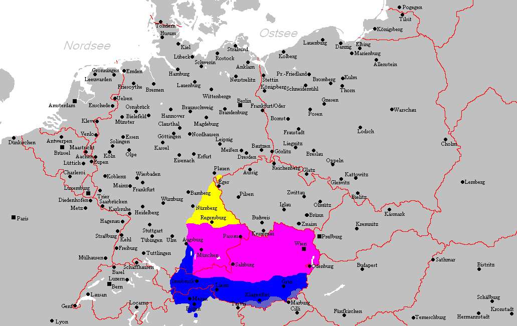
Español: Distribución del Bavariano.
- design by: Postmann Michael
- Verbreitungsgebiet der heutigen bairischen Mundarten
Nordbairisch
Mittel- oder Donaubairisch
Südbairisch
- Prevalence of modern Bavarian dialects
North Bavarian
Central or Danube Bavarian
South Bavarian
- Quelle: Selbst erstellt.
- Hinweis: Nach den Vorgaben des "Der Fischer-Informationsatlas der Bundesrepublik Deutschland" (ISBN 3-596-24556-4) von 1990 (S. 63) selbst erstellt. Es wurde die sowohl die Karte Westmitteleuropas als auch das bayrische Sprachgebiet vom Autor händisch erstellt. Diese Karte ist gemeinfrei und darf von jedermann verwendet werden!
- Source: Self-made.
- Notes: Information derived from "The Fischer Information Atlas of the Federal Republic of Germany" (ISBN 3-596-24556-4) from 1990 (P. 63). Both the map of west Central Europe and the Bavarian language area were by hand provided by the author. This map is in the public domain and may be used by everyone!
- Public domain
| This image has been released into the public domain by its author, Postmann Michael. This applies worldwide. In some countries this may not be legally possible; if so: العربية | Български | Deutsch | Ελληνικά | English | Español | Français | Italiano | 日本語 | 한국어 | Polski | Русский | Српски / Srpski | Svenska | தமிழ் | Українська | 中文(繁體) | 中文(简体) +/- |
Historique du fichier
Cliquer sur une date et une heure pour voir le fichier tel qu’il était à ce moment-là
| Date et heure | Dimensions | Utilisateur | Commentaire | |
|---|---|---|---|---|
| actuel | 2 mars 2006 à 06:10 | 1 031×651 (57 Kio) | Postmann Michael |
Pages contenant l’image
La page ci-dessous contient cette image :

