Image:Azuchimomoyama-japan.png
Un article de Wikipédia, l'encyclopédie libre.
Taille de cet aperçu : 621 × 600 pixels
Image en plus haute résolution (930 × 898 pixels, taille du fichier : 102 Kio, type MIME : image/png)
| | Ce fichier provient de Wikimedia Commons?. Les informations le concernant sont affichées ci-dessous (procédure). |
| Description |
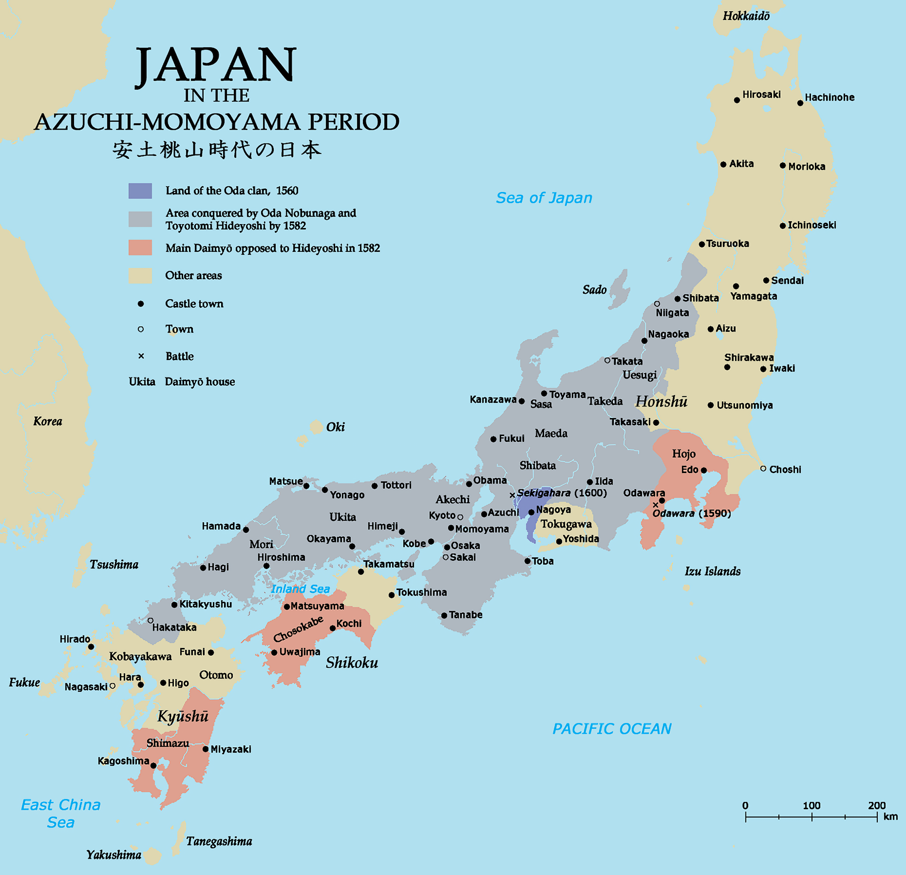
Map of Japan in the Azuchi-Momoyama period. |
||
|---|---|---|---|
| Source |
Self-made; base map from Demis MapClip; all information from The Cassell Atlas of World History by John Haywood et al. (Cassell 1997) |
||
| Date |
July 9, 2007 |
||
| Author |
Zakuragi |
||
| Permission (Reusing this image) |
|

Historique du fichier
Cliquer sur une date et une heure pour voir le fichier tel qu’il était à ce moment-là
| Date et heure | Dimensions | Utilisateur | Commentaire | |
|---|---|---|---|---|
| actuel | 9 juillet 2007 à 21:30 | 930×898 (102 Kio) | Tonym88 | ({{Information |Description= Map of Japan in the Azuchi-Momoyama period. |Source= Self-made; base map from [http://www.demis.nl/wms/mapclip.htm Demis MapClip]; all information from ''The Cassell Atlas of World History'' by John Haywood ''et al.'' (Cassell ) |
Pages contenant l’image
La page ci-dessous contient cette image :

