Image:ArrEekloLocation.png
Un article de Wikipédia, l'encyclopédie libre.
Pas de plus haute résolution disponible.
ArrEekloLocation.png (270 × 203 pixels, taille du fichier : 4 Kio, type MIME : image/png)
| | Ce fichier provient de Wikimedia Commons?. Les informations le concernant sont affichées ci-dessous (procédure). |
[edit] Summary
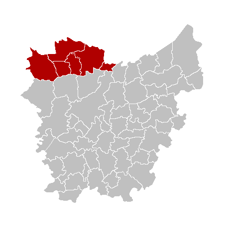
en: Map of the province East-Flanders, showing Eeklo arrondissement in red.
fr: Carte indiquant la localisation de l'arrondissement d'Eeklo (en rouge) dans la province de Flandre orientale.
nl: Kaart van de provincie Oost-Vlaanderen met het arrondissement Eeklo in het in het rood.
| I, the copyright holder of this work, hereby release it into the public domain. This applies worldwide. In case this is not legally possible: Afrikaans | Alemannisch | Aragonés | العربية | Asturianu | Български | Català | Česky | Cymraeg | Dansk | Deutsch | Eʋegbe | Ελληνικά | English | Español | Esperanto | Euskara | Estremeñu | فارسی | Français | Galego | 한국어 | हिन्दी | Hrvatski | Ido | Bahasa Indonesia | Íslenska | Italiano | עברית | Kurdî / كوردی | Latina | Lietuvių | Latviešu | Magyar | Македонски | Bahasa Melayu | Nederlands | Norsk (bokmål) | Norsk (nynorsk) | 日本語 | Polski | Português | Ripoarisch | Română | Русский | Shqip | Slovenčina | Slovenščina | Српски / Srpski | Svenska | ไทย | Tagalog | Türkçe | Українська | Tiếng Việt | Walon | 中文(简体) | 中文(繁體) | zh-yue-hant | +/- |
Historique du fichier
Cliquer sur une date et une heure pour voir le fichier tel qu’il était à ce moment-là
| Date et heure | Dimensions | Utilisateur | Commentaire | |
|---|---|---|---|---|
| actuel | 11 janvier 2006 à 22:06 | 270×203 (4 Kio) | Westermarck |
Pages contenant l’image
Les pages ci-dessous contiennent cette image :

