Image:Administrative division of denmark in medieval times.jpg
Un article de Wikipédia, l'encyclopédie libre.
Taille de cet aperçu : 800 × 583 pixels
Image en plus haute résolution (5 952 × 4 336 pixels, taille du fichier : 16,87 Mio, type MIME : image/jpeg)
| | Ce fichier provient de Wikimedia Commons?. Les informations le concernant sont affichées ci-dessous (procédure). |
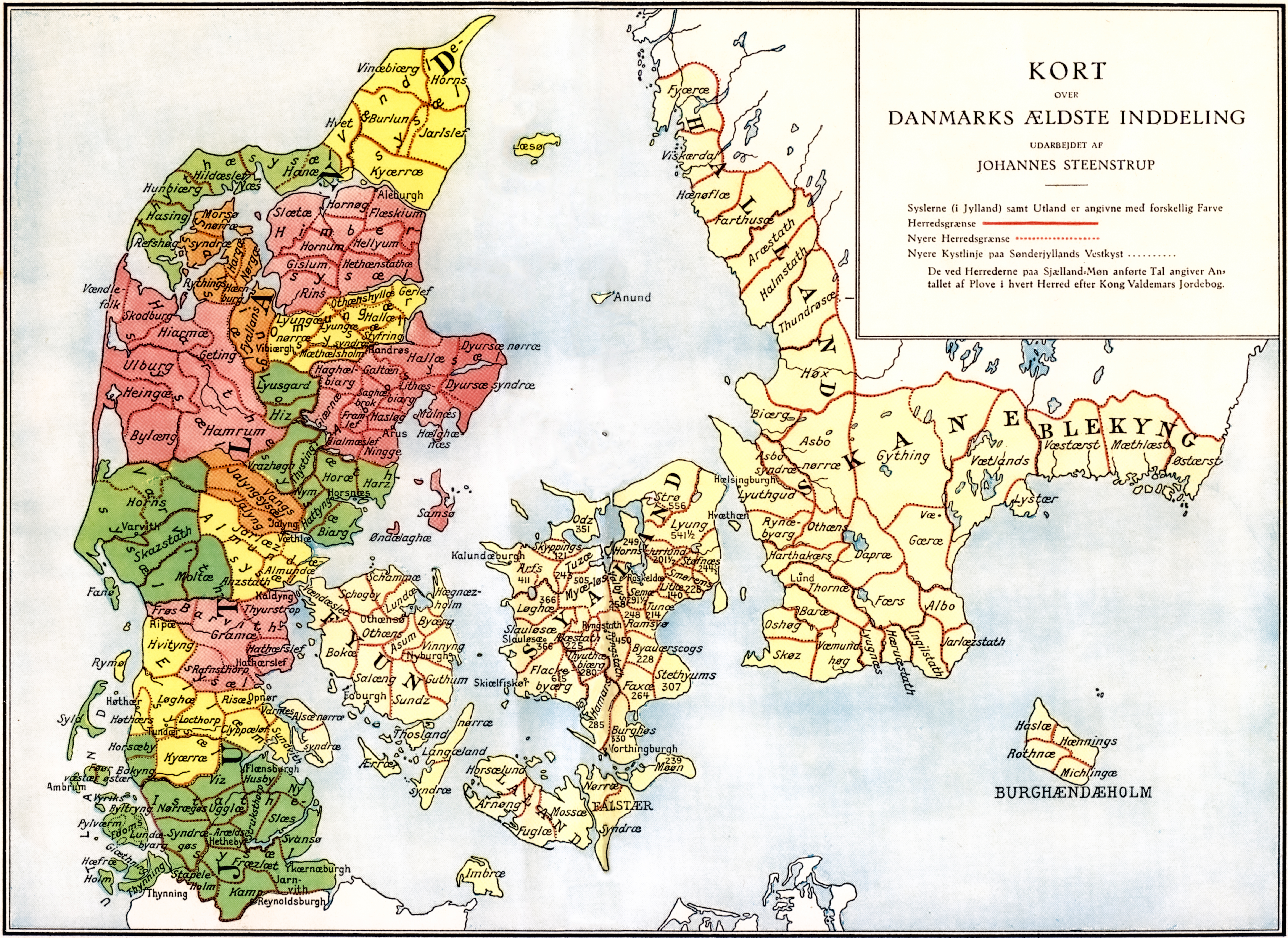
Administrative division of Denmark in Medieval times. The different colors indicate the division in sysler in Jutland while the red lines indicate borders between herreder (hundreds). Dotted red lines indicate newer borders.
Note:The four purely ecclesiastic sysler on Zealand are not included on this map.
The map is made by professor Johannes Steenstrup (died 1935) for use in Danmarks Riges Historie (1900) and is in Public Domain because of the age.
| This image (or other media file) is in the public domain because its copyright has expired. This applies to the United States, Canada, the European Union and those countries with a copyright term of life of the author plus 70 years.
العربية | Asturianu | Български | Català | Česky | Dansk | Deutsch | English | Ελληνικά | Esperanto | Español | Euskara | فارسی | Français | Gaeilge | Galego | עברית | हिन्दी | Bahasa Indonesia | Italiano | 日本語 | 한국어 | Kurdî / كوردی | Lietuvių | Magyar | Nederlands | Norsk (nynorsk) | Македонски | Bahasa Melayu | Polski | Português | Română | Русский | Slovenčina | Slovenščina | Shqip | Suomi | Sámegiella | Türkçe | 中文(简体) | 中文(繁體) | 粵語 | +/- |
Historique du fichier
Cliquer sur une date et une heure pour voir le fichier tel qu’il était à ce moment-là
| Date et heure | Dimensions | Utilisateur | Commentaire | |
|---|---|---|---|---|
| actuel | 19 juin 2005 à 07:36 | 5 952×4 336 (16,87 Mio) | Heelgrasper | (Administrative division of Denmark in Medieval times. The different colors indicate the division in "sysler" in Jutland while the red lines indicate borders between "herreder" (counties). Dotted red lines indicate never borders. The map is made by profes) |
Pages contenant l’image
La page ci-dessous contient cette image :

