Image:A view down into the Okavango Delta.jpg
Un article de Wikipédia, l'encyclopédie libre.
Taille de cet aperçu : 800 × 536 pixels
Image en plus haute résolution (3 872 × 2 592 pixels, taille du fichier : 2,74 Mio, type MIME : image/jpeg)
| | Ce fichier provient de Wikimedia Commons?. Les informations le concernant sont affichées ci-dessous (procédure). |
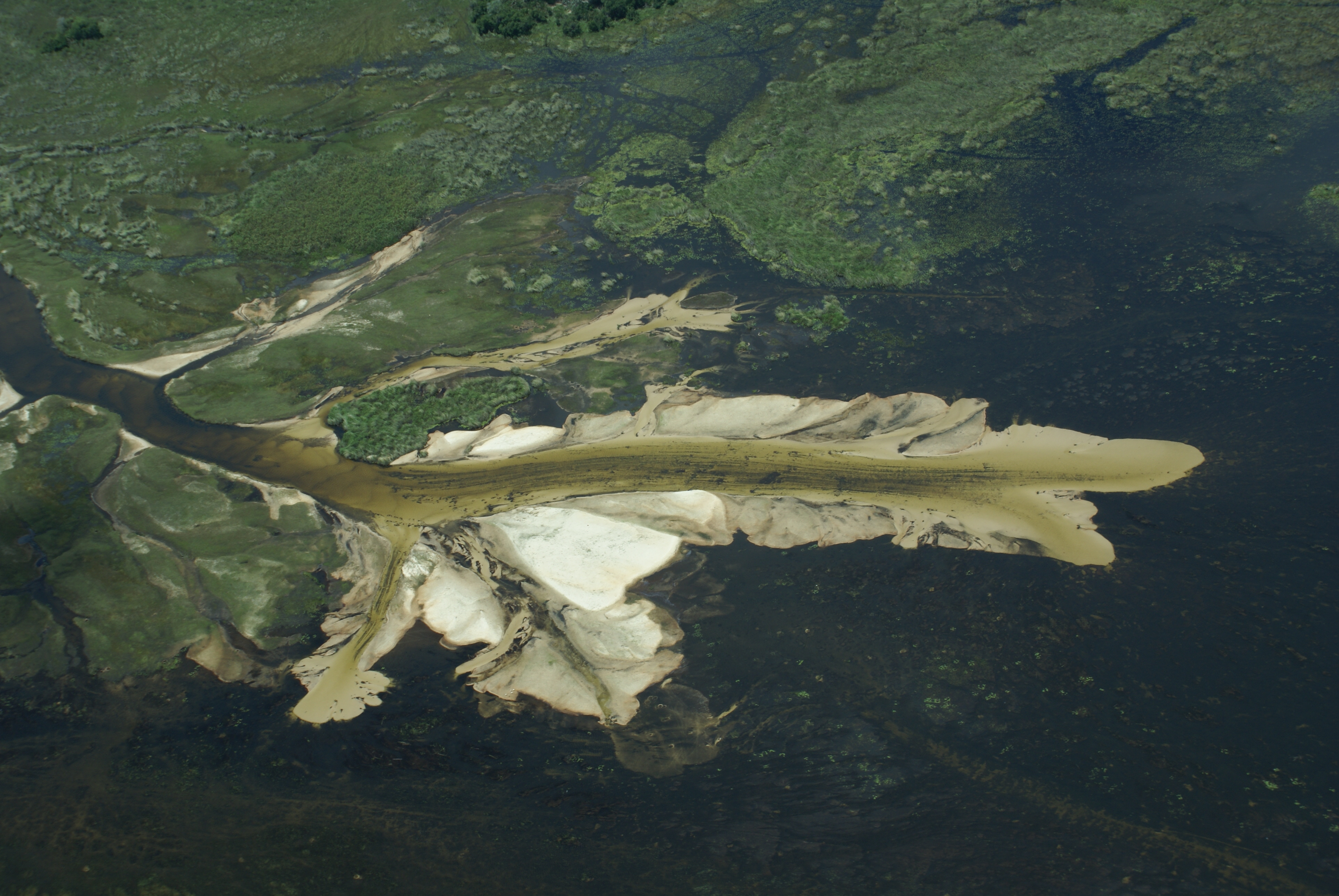
| Description |
The spread of some silt from a South-bound water flow into the Okavango Delta in Botswana. |
|---|---|
| Source | |
| Date |
January 03, 2007 at 05:32 |
| Author |
Justin Hall from Culver City, USA |
| Permission (Reusing this image) |
see below |
| Camera location |
|
Google Maps - Live Maps - Trails.com - TerraServer-USA |
|---|
[edit] Licensing
| This file is licensed under Creative Commons Attribution 2.0 License |
 |
This image was originally posted to Flickr by justin at http://flickr.com/photos/35034345586@N01/355932189. It was reviewed on 18:18, 10 May 2008 (UTC) by FlickreviewR, and confirmed to be licensed under the terms of the cc-by-2.0. |
Historique du fichier
Cliquer sur une date et une heure pour voir le fichier tel qu’il était à ce moment-là
| Date et heure | Dimensions | Utilisateur | Commentaire | |
|---|---|---|---|---|
| actuel | 10 mai 2008 à 18:18 | 3 872×2 592 (2,74 Mio) | Tekken50 | ({{Information |Description= The spread of some silt from a South-bound water flow into the [http://en.wikipedia.org/wiki/Okavango_Delta Okavango Delta] in Botswana. |Source=[http://www.flickr.com/photos/35034345586@N01/355932189/ a view down into the Okav) |
Pages contenant l’image
La page ci-dessous contient cette image :
Métadonnées
Ce fichier contient des informations supplémentaires probablement ajoutées par l’appareil photo numérique ou le numériseur qui l’a acquis. Si le fichier a été modifié depuis son état original, certains détails peuvent ne pas refléter entièrement l’image modifiée.
| Fabricant de l’appareil | SONY |
|---|---|
| Modèle de l’appareil | DSLR-A100 |
| Temps d’exposition | 1/160 sec (0.00625) |
| Ouverture | f/11 |
| Date de la prise originelle | 3 janvier 2007 à 05:32 |
| Longueur focale | 40 mm |
| Description de l’image | SONY DSC |
| Orientation | Normale |
| Résolution horizontale | 72 dpi |
| Résolution verticale | 72 dpi |
| Logiciel utilisé | DSLR-A100 v1.02 |
| Date de modification | 3 janvier 2007 à 05:32 |
| Positionnement YCbCr | 1 |
| Programme d’exposition | Programme normal |
| Sensibilité ISO | 100 |
| Version EXIF | 2.21 |
| Date de la numérisation | 3 janvier 2007 à 05:32 |
| Mode de compression de l’image | 8 |
| Luminance | 9.37 |
| Correction d’exposition | 0 |
| Ouverture maximale | 4.97 |
| Mode de mesure | Modèle |
| Source de lumière | Inconnue |
| Flash | 24 |
| Espace colorimétrique | sRGB |
| Rendu personnalisé | Procédé normal |
| Mode d’exposition | Automatique |
| Balance des blancs | Automatique |
| Taux de zoom numérique | 0 |
| Longueur focale pour un film 35 mm | 60 |
| Type de capture de la scène | Standard |
| Contraste | Normal |
| Saturation | Normale |
| Netteté | Normale |

