Image:United States 1860-1870.gif
Un article de Wikipédia, l'encyclopédie libre.
Pas de plus haute résolution disponible.
United_States_1860-1870.gif (787 × 483 pixels, taille du fichier : 49 Kio, type MIME : image/gif)
| | Ce fichier provient de Wikimedia Commons?. Les informations le concernant sont affichées ci-dessous (procédure). |
[edit] Summary
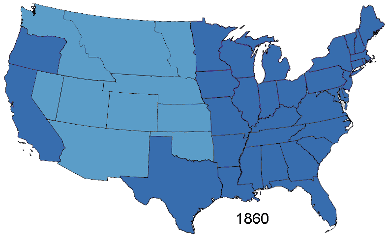
Animated map showing Confederacy, American Civil War and re-admission of southern states to the Union, made in Photoshop.
██ States of the Union
██ Territories of the Union (including occupied territory during and after the war)
██ States of the Confederacy
██ Territories of the Confederacy
Based on Tomf688's Creative Commons licenced 1861 map and GNU-licenced 1864 map. Information from wikipedia articles Confederate States of America, List of U.S. states by date of statehood, and from external site When states became states. Civil war borders used from public domain Perry-Castañeda Library Map Collection 1861-65 map. Border between Arizona Territory (CSA) and New Mexico Territory is that depicted in public domain map Image:Map of CSA 4.png
[edit] Licensing
As the maps this was based on were licenced as GFDL and creative commons (not including the public domain maps), this is licenced under both licences.

| This file is licensed under the Creative Commons Attribution ShareAlike 2.5 License. In short: you are free to share and make derivative works of the file under the conditions that you appropriately attribute it, and that you distribute it only under a license identical to this one. Official license |
Historique du fichier
Cliquer sur une date et une heure pour voir le fichier tel qu’il était à ce moment-là
| Date et heure | Dimensions | Utilisateur | Commentaire | |
|---|---|---|---|---|
| actuel | 2 août 2006 à 07:00 | 787×483 (49 Kio) | Roke | (Animated map showing Confederacy, American Civil War and re-admission of southern states to the Union, made in Photoshop. {{legend|#376dae|States of the Union}} {{legend|#5b9dc8|Territories of the Union (including occupied territory during and after the) |
Pages contenant l’image
Les pages ci-dessous contiennent cette image :

