Image:Sidr map.JPG
Un article de Wikipédia, l'encyclopédie libre.
Taille de cet aperçu : 800 × 598 pixels
Image en plus haute résolution (835 × 624 pixels, taille du fichier : 111 Kio, type MIME : image/jpeg)
| | Ce fichier provient de Wikimedia Commons?. Les informations le concernant sont affichées ci-dessous (procédure). |
[edit] Summary
| Description |
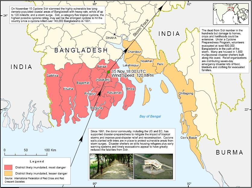
Map showing Sidr affected districts and disaster response. |
|---|---|
| Source | |
| Date |
2007-11-16 |
| Author |
Humanitarian Information Unit, US Department of State |
| Permission (Reusing this image) |
see below |
[edit] Licensing
| This work is in the public domain in the United States because it is a work of the United States Federal Government under the terms of Title 17, Chapter 1, Section 105 of the US Code. See Copyright.
Note: This only applies to works of the Federal Government and not to the work of any individual U.S. state, territory, commonwealth, county, municipality, or any other subdivision. العربية | Български | Česky | Deutsch | English | Español | Français | Magyar | Italiano | 日本語 | 한국어 | Polski | Português | 中文(繁體) | 中文(简体) | +/- |
 |
Historique du fichier
Cliquer sur une date et une heure pour voir le fichier tel qu’il était à ce moment-là
| Date et heure | Dimensions | Utilisateur | Commentaire | |
|---|---|---|---|---|
| actuel | 27 janvier 2008 à 04:20 | 835×624 (111 Kio) | Armanaziz | ({{Information |Description=Map showing Sidr affected districts and disaster response. |Source=[http://hiu.state.gov/index.cfm?fuseaction=public.display&id=2cc5a2c6-cc56-4ee2-a9d7-279b2d941233 from HIU, US Dpt. of State] |Date=2007-11-16 |Author=Humanitari) |
Pages contenant l’image
La page ci-dessous contient cette image :

