Image:Sf-map.png
Un article de Wikipédia, l'encyclopédie libre.
Pas de plus haute résolution disponible.
Sf-map.png (329 × 353 pixels, taille du fichier : 11 Kio, type MIME : image/png)
| | Ce fichier provient de Wikimedia Commons?. Les informations le concernant sont affichées ci-dessous (procédure). |
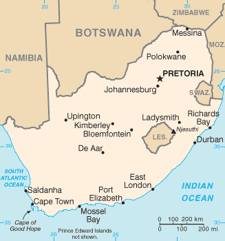
English: CIA map of South Africa
 |
This map image should be recreated using vector graphics as an SVG file. This has several advantages; see Commons:Media for cleanup for more information. If an SVG form of this image is already available, please upload it. After uploading an SVG, replace this template with template {{Vector version available|new image name.svg}} in this image. |
|
العربية | Български | Català | Česky | Dansk | Deutsch | English | Esperanto | Español | Français | 한국어 | Italiano | Magyar | Lietuvių | Nederlands | 日本語 | Polski | Português | Română | Русский | Suomi | Svenska | Türkçe | Українська | Tiếng Việt | मराठी | 中文(繁體) | 中文(简体) | +/- |
|
| This image is in the public domain because it contains materials that originally came from the United States Central Intelligence Agency's World Factbook.
Deutsch | English | Español | Français | 日本語 | Nederlands | 한국어 | Português | தமிழ் | Magyar | +/- |
 |
Historique du fichier
Cliquer sur une date et une heure pour voir le fichier tel qu’il était à ce moment-là
| Date et heure | Dimensions | Utilisateur | Commentaire | |
|---|---|---|---|---|
| actuel | 30 septembre 2006 à 23:02 | 329×353 (11 Kio) | Samulili | (Reverted to earlier revision) |
| 29 septembre 2006 à 16:50 | 330×355 (15 Kio) | Loveless | (This image was copied from wikipedia:fr. The original description was: Carte de l'Afrique du Sud Tiré du CIA world factbook : http://www.cia.gov/cia/publications/factbook/geos/sf.html {{DomainePublic}} {| border="1" ! date/time || username || resoluti) | |
| 5 mars 2005 à 01:11 | 329×353 (11 Kio) | Alfio | (CIA map of South Africa) |
Pages contenant l’image
Les pages ci-dessous contiennent cette image :

