Image:Salt dome hg.png
Un article de Wikipédia, l'encyclopédie libre.
Taille de cet aperçu : 800 × 359 pixels
Image en plus haute résolution (1 153 × 517 pixels, taille du fichier : 94 Kio, type MIME : image/png)
| | Ce fichier provient de Wikimedia Commons?. Les informations le concernant sont affichées ci-dessous (procédure). |
| Description |
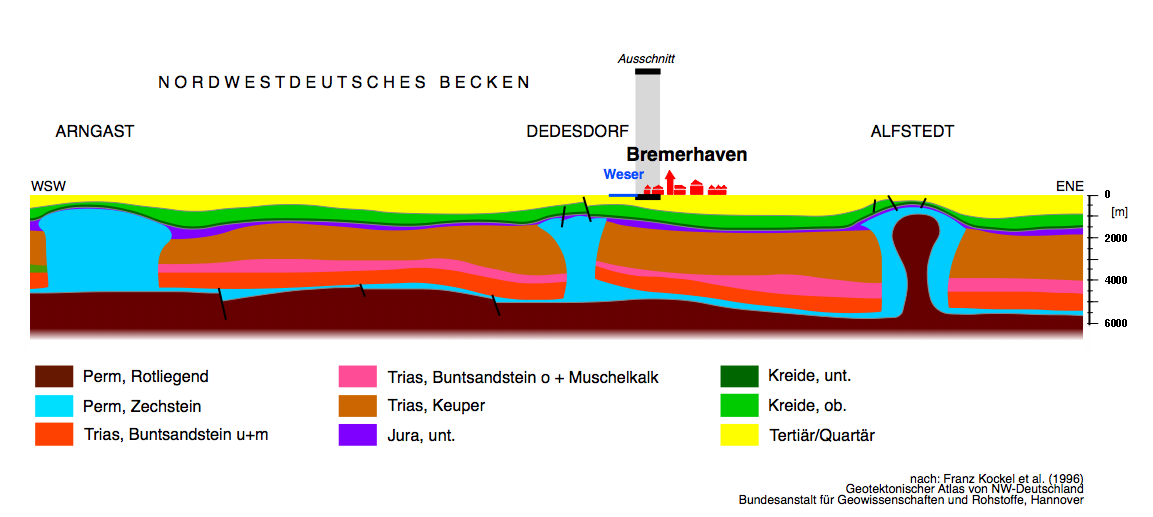
Geological cross section through the Northwestern Basin of Germany (Ostfriesland-Nordheide) showing the record and deposits since Perm (ab 250 Million years). Salt domes of the Zechstein have penetrated the following layers and moved up close to the surface. |
|---|---|
| Source |
own work |
| Date |
2006-11-05 |
| Author |
grafic by Hannes Grobe 21:36, 5 November 2006 (UTC), redrawn from Baldschuhn, R.; Frisch, U. & Kockel, F. Geotektonischer Atlas von NW-Deutschland, 1:300 000, Bundesanstalt für Geowissenschaften und Rohstoffe (BGR), Hannover (1996). Teil 17 Geologische Schnitte 1:200 000, Tafel 3: Ostfriesland-Nordheide, Schnitt 32. |
| Permission (Reusing this image) |
Own work, share alike, attribution required (Creative Commons CC-BY-SA-2.5) |
| Other versions | Image:Salt_dome_hg.svg |
|
Historique du fichier
Cliquer sur une date et une heure pour voir le fichier tel qu’il était à ce moment-là
| Date et heure | Dimensions | Utilisateur | Commentaire | |
|---|---|---|---|---|
| actuel | 5 novembre 2006 à 23:36 | 1 153×517 (94 Kio) | Hgrobe | ({{Information |Description= |Source=own work |Date=2006-11-05 |Author=~~~~ |Permission=Own work, share alike, attribution required (Creative Commons CC-BY-SA-2.5) |other_versions= }} {{self|cc-by-sa-2.5}}) |
Pages contenant l’image
La page ci-dessous contient cette image :

