Image:SaltGlaciers ZagrosMtns 20010810.jpg
Un article de Wikipédia, l'encyclopédie libre.
Taille de cet aperçu : 800 × 509 pixels
Image en plus haute résolution (1 149 × 731 pixels, taille du fichier : 231 Kio, type MIME : image/jpeg)
| | Ce fichier provient de Wikimedia Commons?. Les informations le concernant sont affichées ci-dessous (procédure). |
[edit] Summary
| Description |
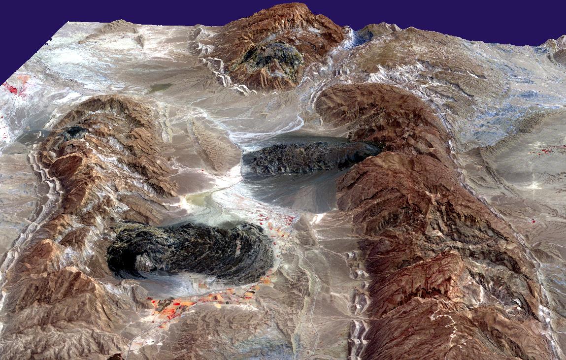
Satellite imagery of w:salt domes and w:salt glaciers in the w:Zagros Mountains of southern Iran. This w:ASTER perspective view was created by draping a band 3-2-1 (RGB) image over an ASTER-derived Digital Elevation Model (2x vertical exaggeration). |
|---|---|
| Source |
http://earthobservatory.nasa.gov/Newsroom/NewImages/images.php3?img_id=16435 |
| Date |
August 10, 2001 |
| Author |
NASA/GSFC/MITI/ERSDAC/JAROS, and U.S./Japan ASTER Science Team |
| Permission (Reusing this image) |
US government, public domain |
[edit] Licensing
|
|
This file is in the public domain because it was created by NASA. NASA copyright policy states that "NASA material is not protected by copyright unless noted". (NASA copyright policy page or JPL Image Use Policy).
Deutsch | English | Español | Français | Nederlands | Português | Русский | 中文(简体) | 中文(繁體) | +/- |
|
 |
Warnings:
|
Historique du fichier
Cliquer sur une date et une heure pour voir le fichier tel qu’il était à ce moment-là
| Date et heure | Dimensions | Utilisateur | Commentaire | |
|---|---|---|---|---|
| actuel | 27 avril 2006 à 18:49 | 1 149×731 (231 Kio) | Howcheng | ({{Information | Description=Satellite imagery of w:salt domes and w:salt glaciers in the w:Zagros Mountains of southern Iran. This w:ASTER perspective view was created by draping a band 3-2-1 (RGB) image over an ASTER-derived Digital Eleva) |
Pages contenant l’image
La page ci-dessous contient cette image :

