Image:Rottnest Island.jpg
Un article de Wikipédia, l'encyclopédie libre.
Taille de cet aperçu : 800 × 354 pixels
Image en plus haute résolution (826 × 366 pixels, taille du fichier : 80 Kio, type MIME : image/jpeg)
| | Ce fichier provient de Wikimedia Commons?. Les informations le concernant sont affichées ci-dessous (procédure). |
| Description |
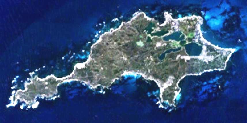
This is a map of the Rottnest Island, Western Australia, made with World Wind using Landsat 7 data. |
|||
|---|---|---|---|---|
| Source | No source specified. Please edit this image description and provide a source. | |||
| Date | ||||
| Author |
Created by the uploader. Any IP involved in the creation of this image is released into the public domain. |
|||
| Permission (Reusing this image) |
|
Historique du fichier
Cliquer sur une date et une heure pour voir le fichier tel qu’il était à ce moment-là
| Date et heure | Dimensions | Utilisateur | Commentaire | |
|---|---|---|---|---|
| actuel | 2 mai 2007 à 04:51 | 826×366 (80 Kio) | Moondyne | ({{Information |Description=This is a map of the Rottnest Island, Western Australia, made with World Wind using Landsat 7 data. Sharper img |Source= |Date= |Author=Created by the uploader. Any IP involved in the creation of this image is released into the) |
| 1 mai 2007 à 03:37 | 857×427 (47 Kio) | Moondyne | ({{Information |Description=This is a map of the Rottnest Island, Western Australia, made with World Wind using Landsat 7 data. (Adjusted for contrast) |Source= |Date= |Author=Created by the uploader. Any IP involved in the creation of this image is relea) | |
| 16 novembre 2006 à 05:16 | 857×427 (38 Kio) | Hesperian | ({{Information |Description=This is a map of the Rottnest Island, Western Australia, made with World Wind using Landsat 7 data. |Source= |Date= |Author=Created by the uploader. Any IP involved in the creation of this image is released into the public domai) |
Pages contenant l’image
La page ci-dessous contient cette image :

