Image:Rockall EEZ.jpg
Un article de Wikipédia, l'encyclopédie libre.
Taille de cet aperçu : 623 × 600 pixels
Image en plus haute résolution (864 × 832 pixels, taille du fichier : 97 Kio, type MIME : image/jpeg)
| | Ce fichier provient de Wikimedia Commons?. Les informations le concernant sont affichées ci-dessous (procédure). |
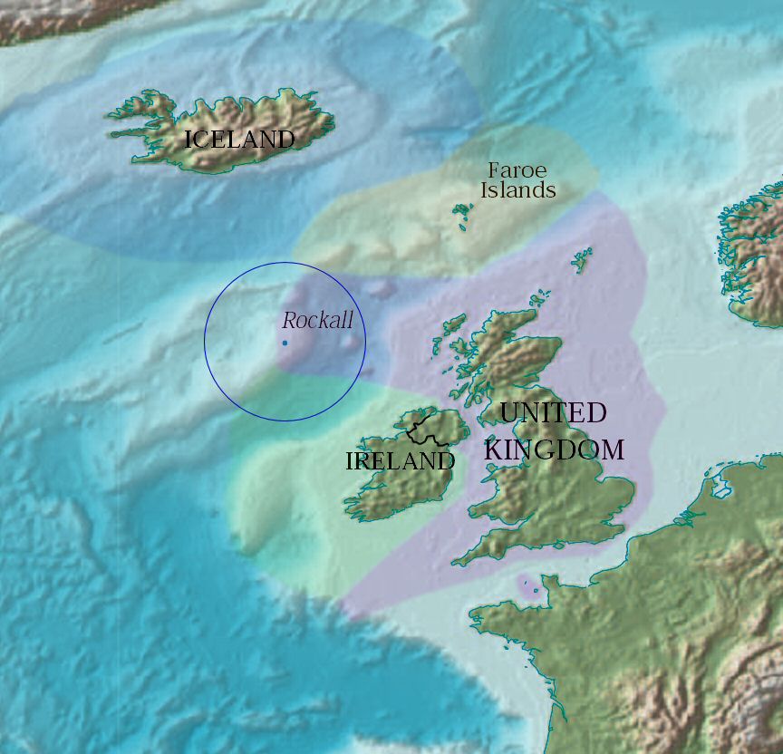
Map showing Rockall and the surrounding Exclusive Economic Zones of the UK, Republic of Ireland, the Faroe Islands (Denmark) and Iceland. The zones have been overlayed by Jooler using a CIA PD map.
It is part of the world map found at [1] (warning: 4Mb), originally published by the CIA as Public Domain (according to the source map).
| This image is in the public domain because it contains materials that originally came from the United States Central Intelligence Agency's World Factbook.
Deutsch | English | Español | Français | 日本語 | Nederlands | 한국어 | Português | தமிழ் | Magyar | +/- |
 |
Historique du fichier
Cliquer sur une date et une heure pour voir le fichier tel qu’il était à ce moment-là
| Date et heure | Dimensions | Utilisateur | Commentaire | |
|---|---|---|---|---|
| actuel | 26 avril 2005 à 18:27 | 864×832 (97 Kio) | Jooler | (Map showing Rockall and the surrounding Exclusive Economic Zones of the UK, Republic of Ireland, the Faroe Islands (Denmark) and Iceland. The zones have been overlayed by Jooler using a CIA PD map. It is part of the world map found at [http://www.lib.ute) |
Pages contenant l’image
La page ci-dessous contient cette image :

