Image:Puerto Rico geography.gif
Un article de Wikipédia, l'encyclopédie libre.

Pas de plus haute résolution disponible.
Puerto_Rico_geography.gif (698 × 333 pixels, taille du fichier : 28 Kio, type MIME : image/gif)
| | Ce fichier provient de Wikimedia Commons?. Les informations le concernant sont affichées ci-dessous (procédure). |
| Description |
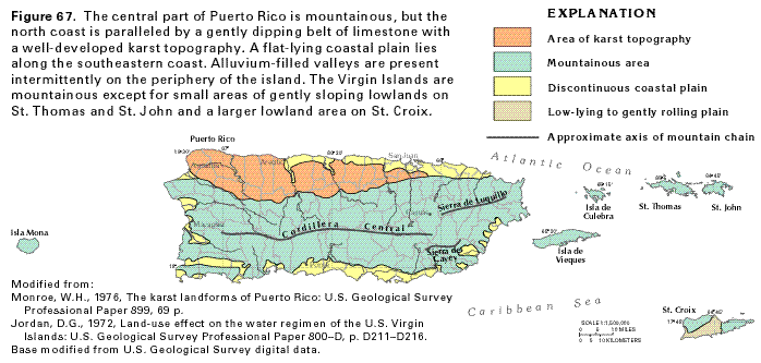
Map of Puerto Rico's geography |
|||
|---|---|---|---|---|
| Source | ||||
| Date | ||||
| Author | ||||
| Permission (Reusing this image) |
|
Historique du fichier
Cliquer sur une date et une heure pour voir le fichier tel qu’il était à ce moment-là
| Date et heure | Dimensions | Utilisateur | Commentaire | |
|---|---|---|---|---|
| actuel | 14 juillet 2006 à 03:28 | 698×333 (28 Kio) | Joelr31 | ({{Information |Description= Map of Puerto Rico's geography |Source=http://capp.water.usgs.gov/gwa/ch_n/gif/N067.gif |Date= |Author= |Permission={{USGS}} |other_versions= }} ) |
Pages contenant l’image
La page ci-dessous contient cette image :

