Image:Palau and oceania.jpg
Un article de Wikipédia, l'encyclopédie libre.
Pas de plus haute résolution disponible.
Palau_and_oceania.jpg (304 × 370 pixels, taille du fichier : 63 Kio, type MIME : image/jpeg)
| | Ce fichier provient de Wikimedia Commons?. Les informations le concernant sont affichées ci-dessous (procédure). |
Transwiki approved by: w:en:User:Dmcdevit
This image was copied from wikipedia:en. The original description was:
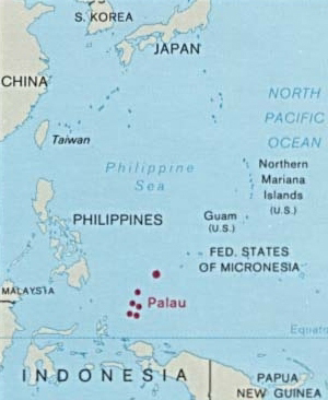
Map of Palau and its location in Oceania from http://www.lib.utexas.edu/maps/palau.html ((Political) CIA 1995)
The source site's Usage statement says that some maps are copyrighted and can only be used for educational uses and some are public domain but can only be used when the source is credited. There is no way that I can tell which it is. — Edwin Stearns | Talk 18:50, 14 Dec 2004 (UTC)
- Unfortunately, I don't have time to copyright stamp all images I have uploaded. I have however only uploaded maps that are according to my best knowledge not copyrighted. I have not used maps that were marked as copyrighted.
Regarding the maps, on the University of Texas map site it is stated: "Most of the maps scanned by the University of Texas Libraries and served from this web site are in the public domain. No permissions are needed to copy them. You may download them and use them as you wish. A few maps are copyrighted, and are clearly marked as such. Any that are copyrighted by The University of Texas are subject to our Materials Usage Guidelines. A few maps include the official seal of a U.S. Government agency. Federal law prohibits use of these seals in connection with any merchandise, impersonation, solicitation, or commercial activity in a manner reasonably calculated to convey the impression that such use is approved, endorsed, or authorized by the agency. We do appreciate hearing from you about your uses of these materials and we would also appreciate your giving this site credit when it is referred to in anything you publish. Other sites may link to our site or to individual maps without our permission." Pascal 23:47, 8 Jan 2005 (UTC)
| This image is a work of a Central Intelligence Agency employee, taken or made during the course of the person's official duties. As a Work of the United States Government, all images created or made by the CIA are in the public domain, with the exception of classified information. |  |
[edit] File history
20:57, 12 August 2003 || w:en:User:Pascal|| 300×366 || 66 KB || Map of Palau and its location in Oceania from http://www.lib.utexas.edu/maps/index.html
| date/time | username | resolution | size | edit summary |
|---|---|---|---|---|
| 21:01, 12 August 2003 | w:en:User:Pascal | 304×370 | 63 KB | Again (now with border) |
[edit] Image description page history
| link | date/time | username | edit summary |
|---|---|---|---|
| http://en.wikipedia.org/w/index.php?title=Image:Palau_and_oceania.jpg&redirect=no&oldid=153959284 | 08:35, 7 September 2007 | w:en:User:Dmcdevit | |
| http://en.wikipedia.org/w/index.php?title=Image:Palau_and_oceania.jpg&redirect=no&oldid=153959284 | 14:43, 27 August 2007 | w:en:User:Jusjih | |
| http://en.wikipedia.org/w/index.php?title=Image:Palau_and_oceania.jpg&redirect=no&oldid=100588484 | 03:57, 14 January 2007 | w:en:User:RadioKirk | |
| http://en.wikipedia.org/w/index.php?title=Image:Palau_and_oceania.jpg&redirect=no&oldid=16166504 | 23:47, 8 January 2005 | w:en:User:Pascal | |
| http://en.wikipedia.org/w/index.php?title=Image:Palau_and_oceania.jpg&redirect=no&oldid=9213872 | 18:50, 14 December 2004 | w:en:User:Edwinstearns | |
| http://en.wikipedia.org/w/index.php?title=Image:Palau_and_oceania.jpg&redirect=no&oldid=8430549 | 20:57, 12 August 2003 | w:en:User:Pascal | (Map of Palau and its location in Oceania from http://www.lib.utexas.edu/maps/index.html) |
Historique du fichier
Cliquer sur une date et une heure pour voir le fichier tel qu’il était à ce moment-là
| Date et heure | Dimensions | Utilisateur | Commentaire | |
|---|---|---|---|---|
| actuel | 8 septembre 2007 à 06:22 | 304×370 (63 Kio) | BetacommandBot | (Transwiki approved by: w:en:User:Dmcdevit This image was copied from wikipedia:en. The original description was: Map of Palau and its location in Oceania from http://www.lib.utexas.edu/maps/palau.html ((Political) CIA 1995) The source site's [http:) |
Pages contenant l’image
La page ci-dessous contient cette image :

